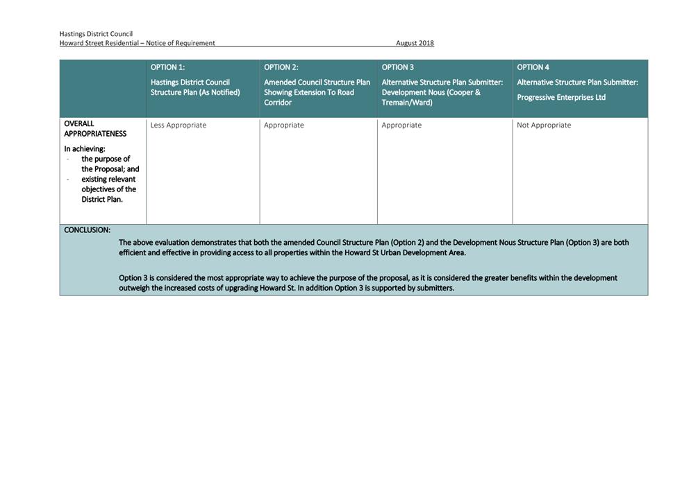
Civic Administration Building
Phone: (06) 871 5000
Fax: (06) 871 5100
Document 2
Commissioner Hearing
Meeting Date: |
Tuesday, 22 January 2019 |
Time: |
9.00am |
Venue: |
Council Chamber Ground Floor Civic Administration Building Lyndon Road East Hastings |
item subject page
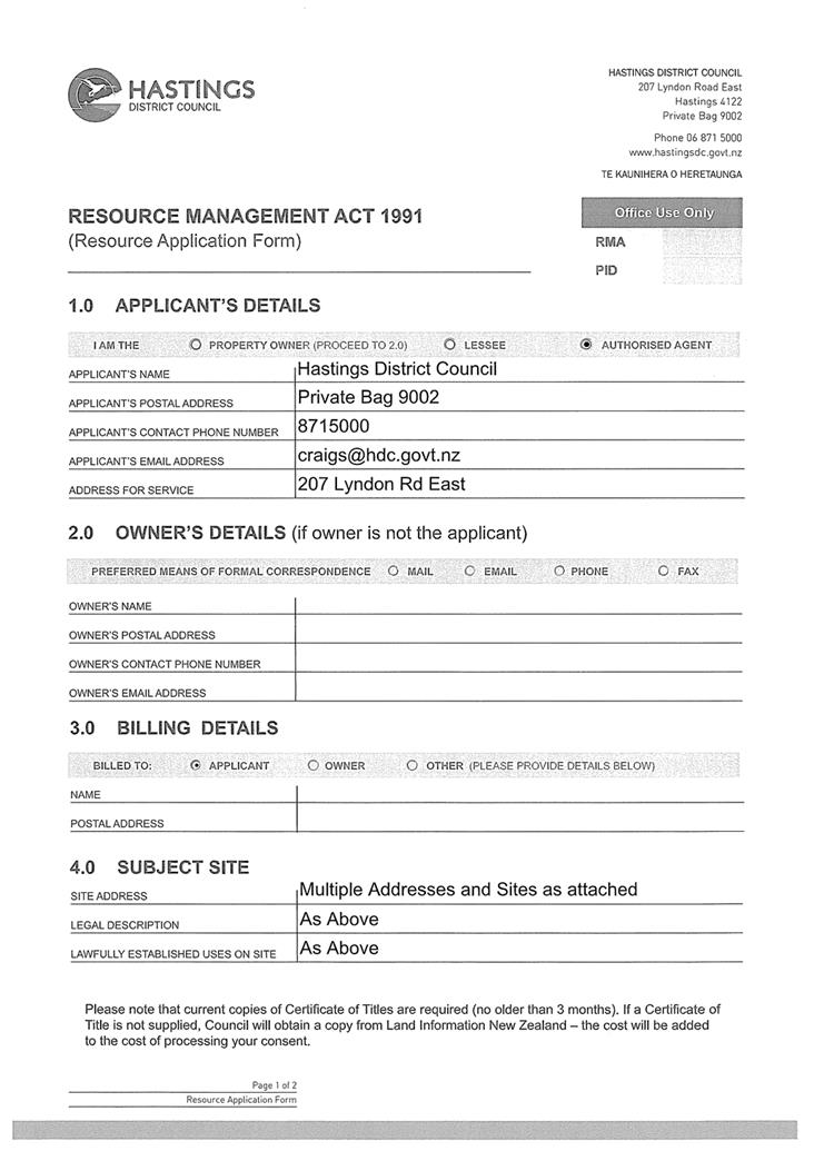
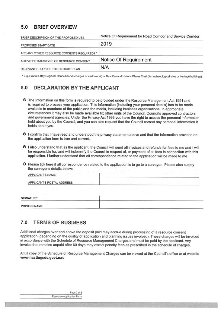
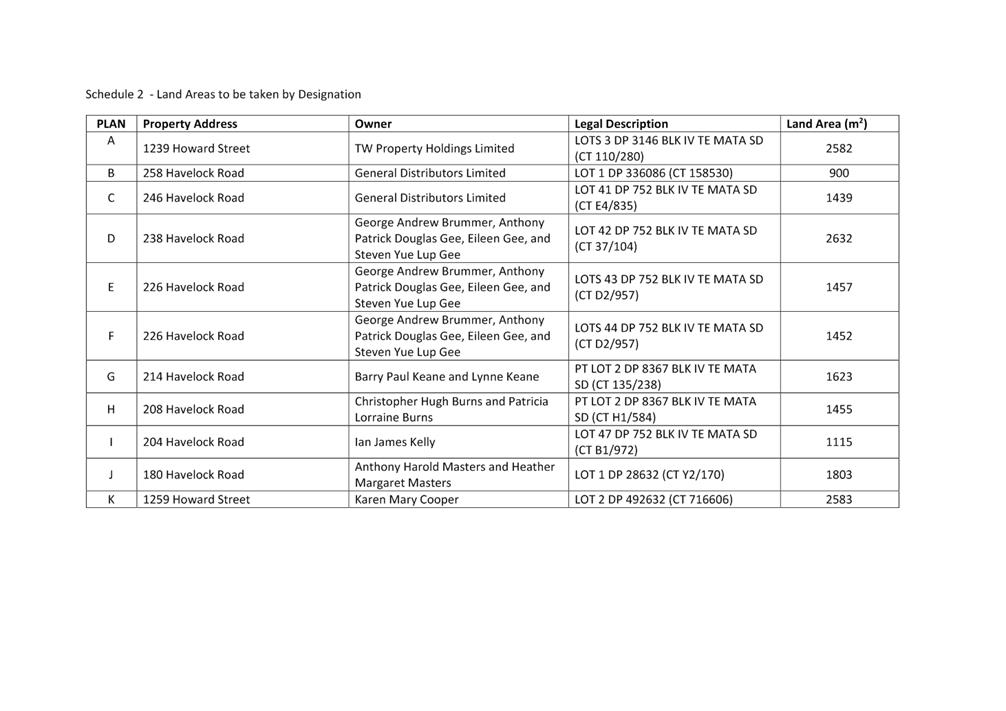
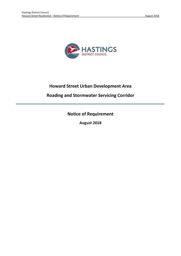
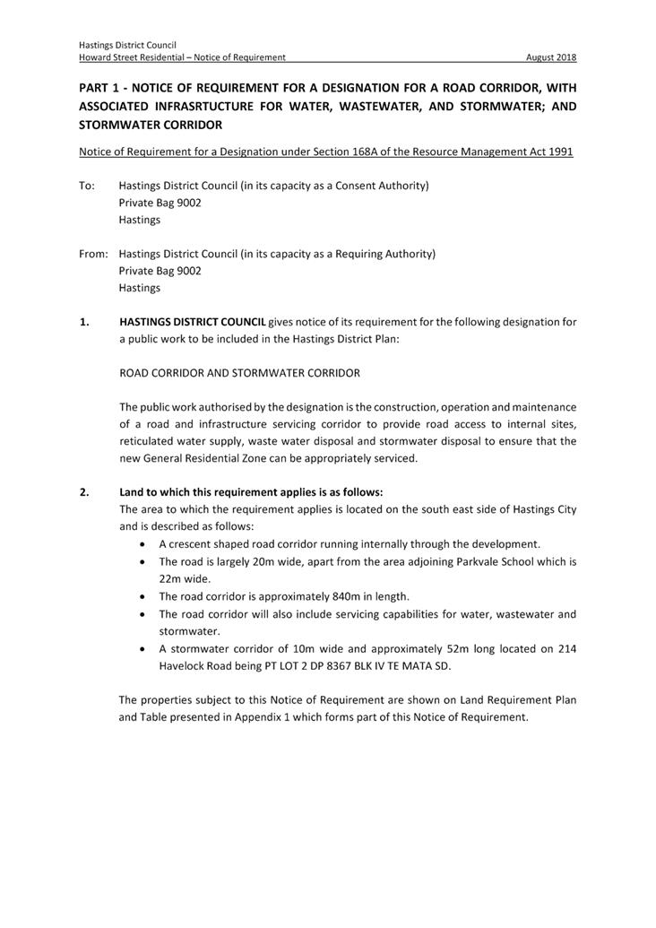
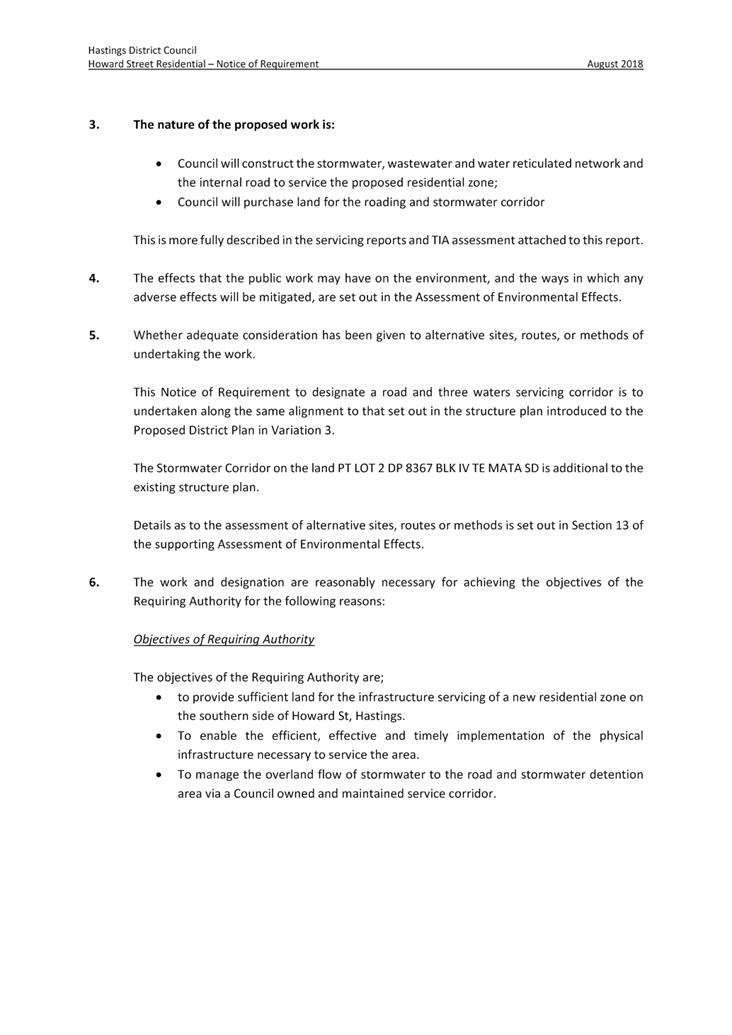
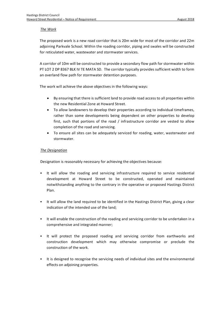
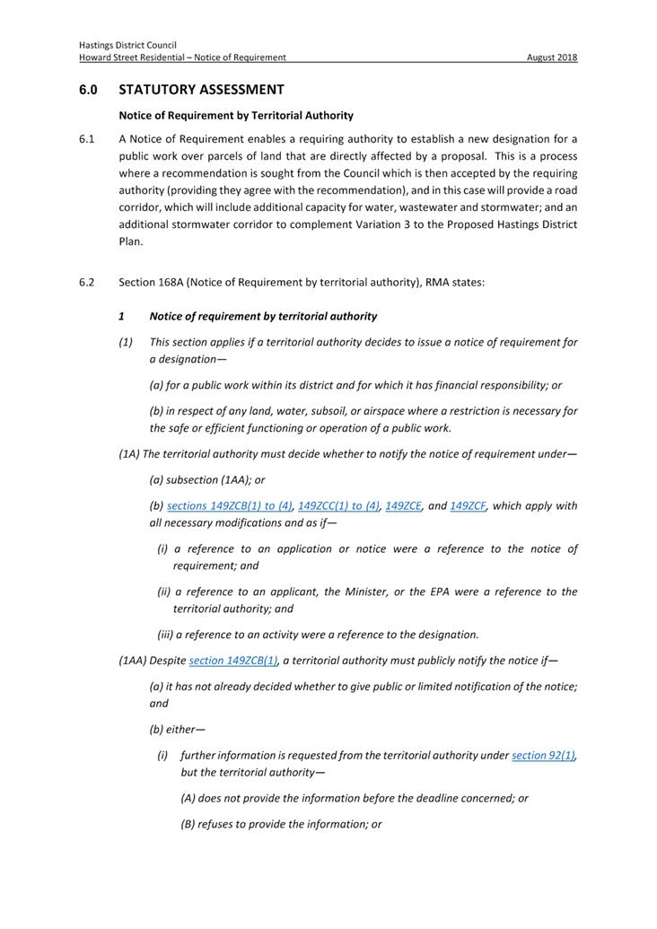
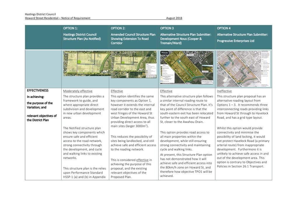
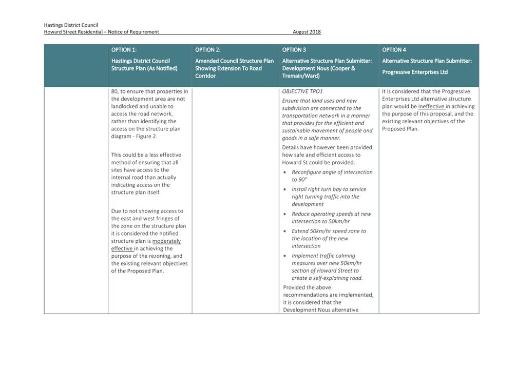
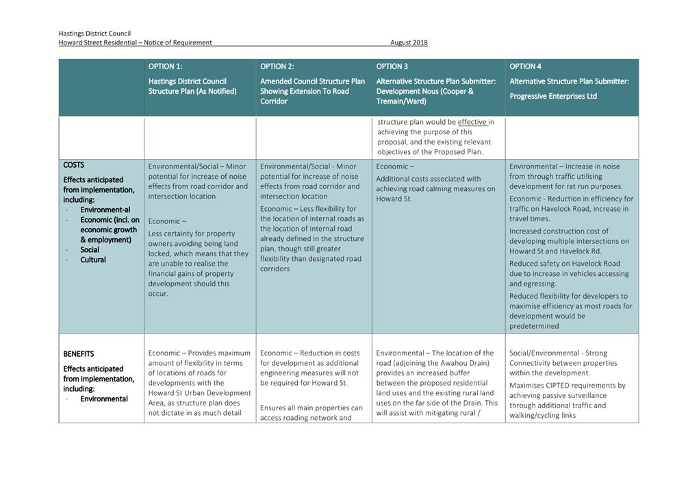
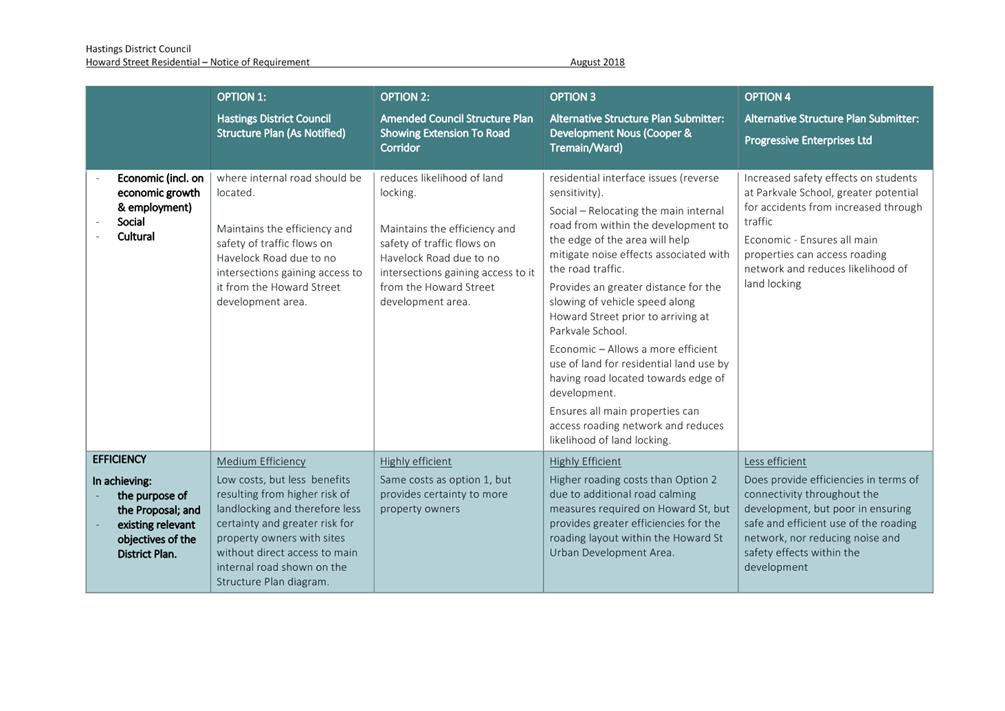
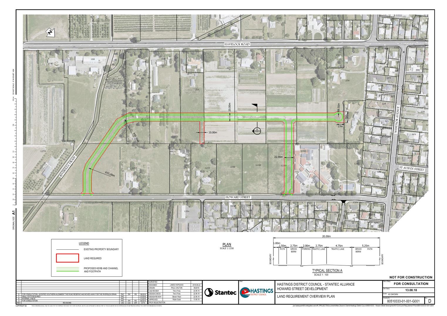
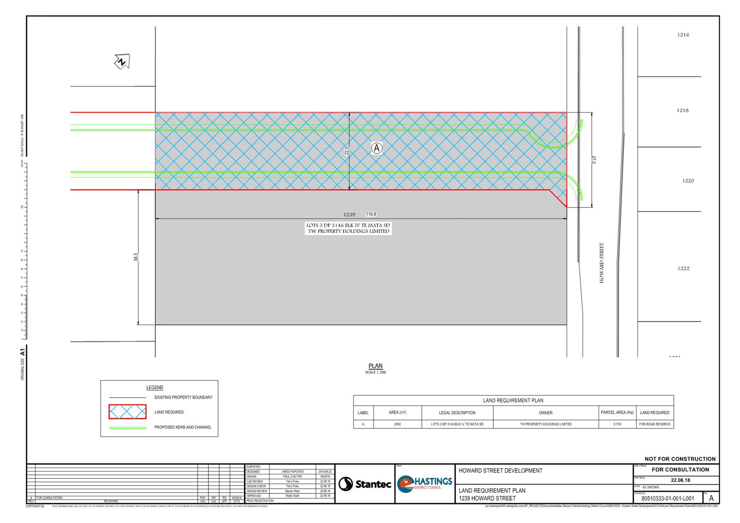
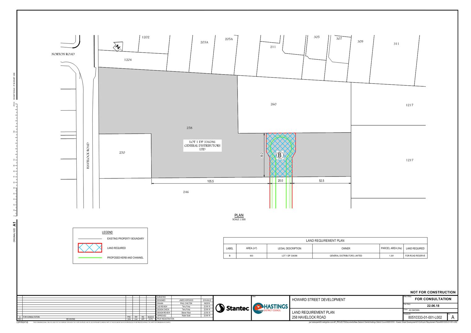
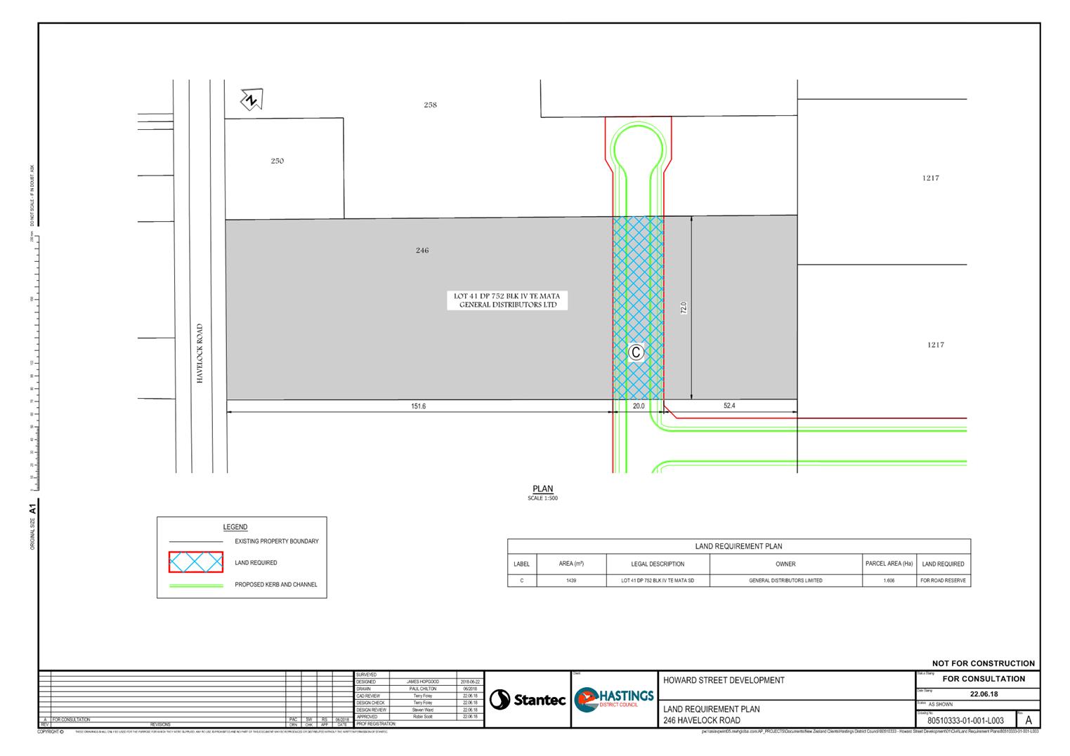
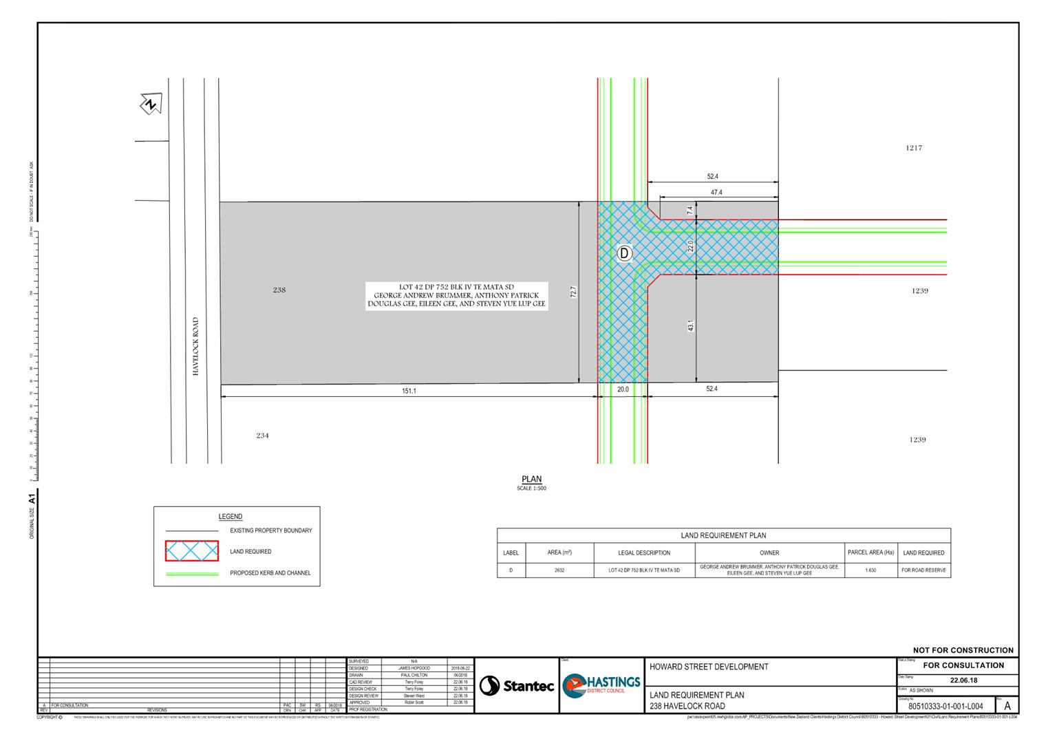
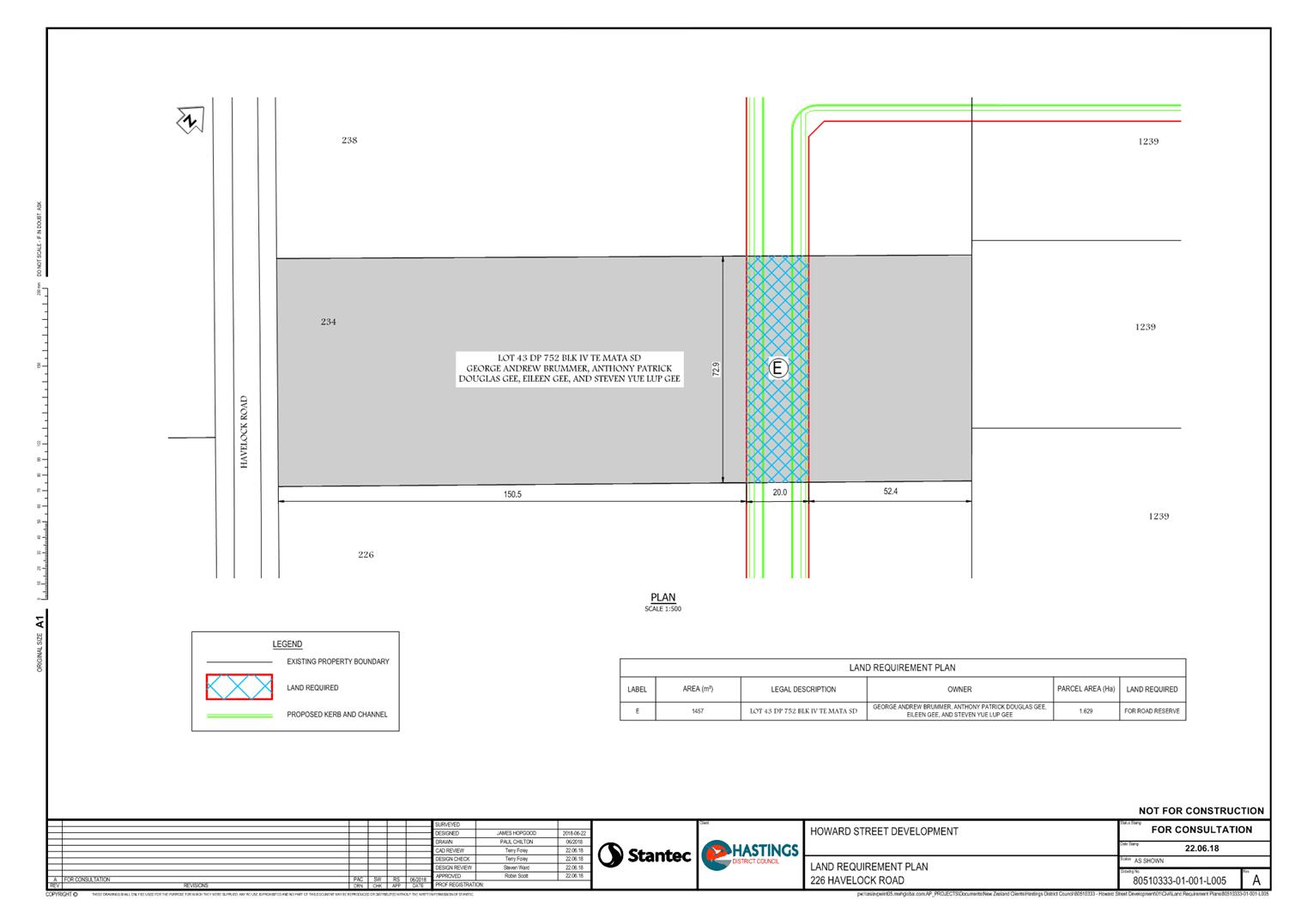
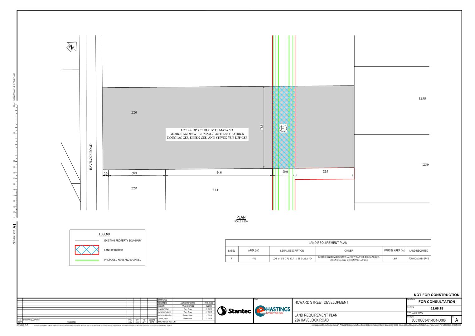
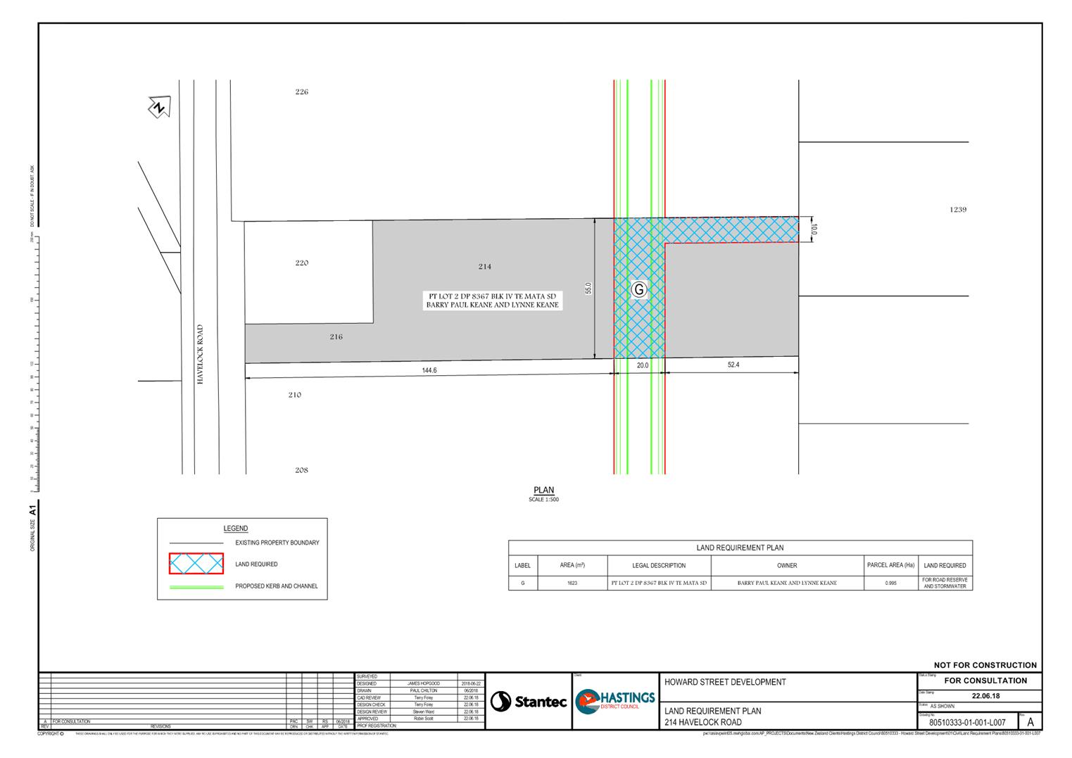
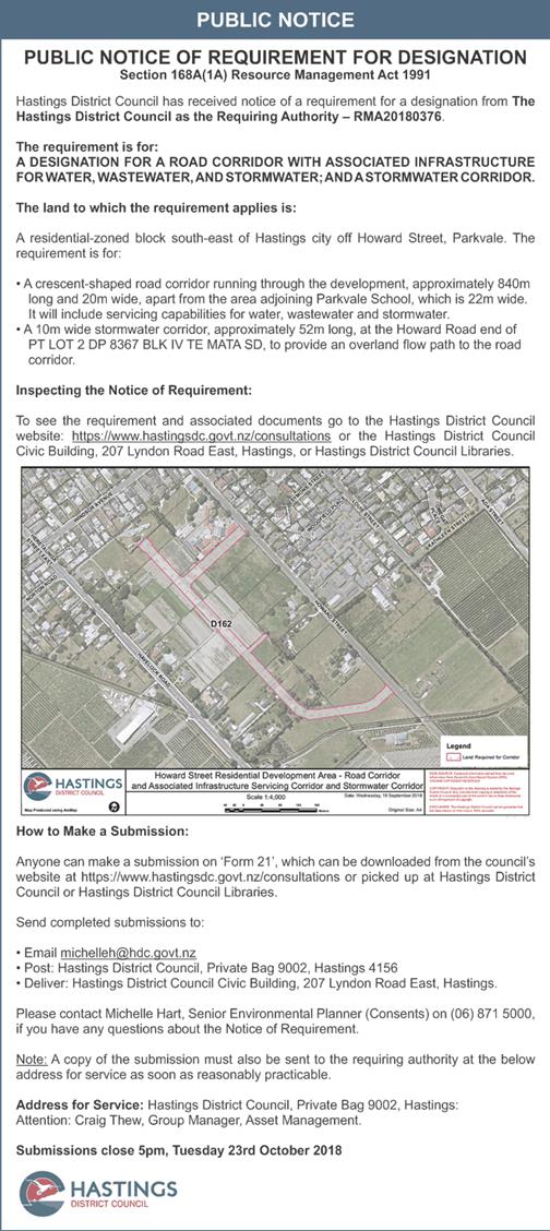
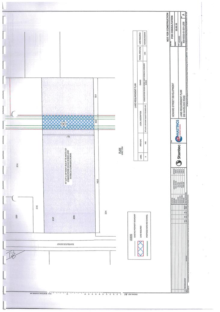
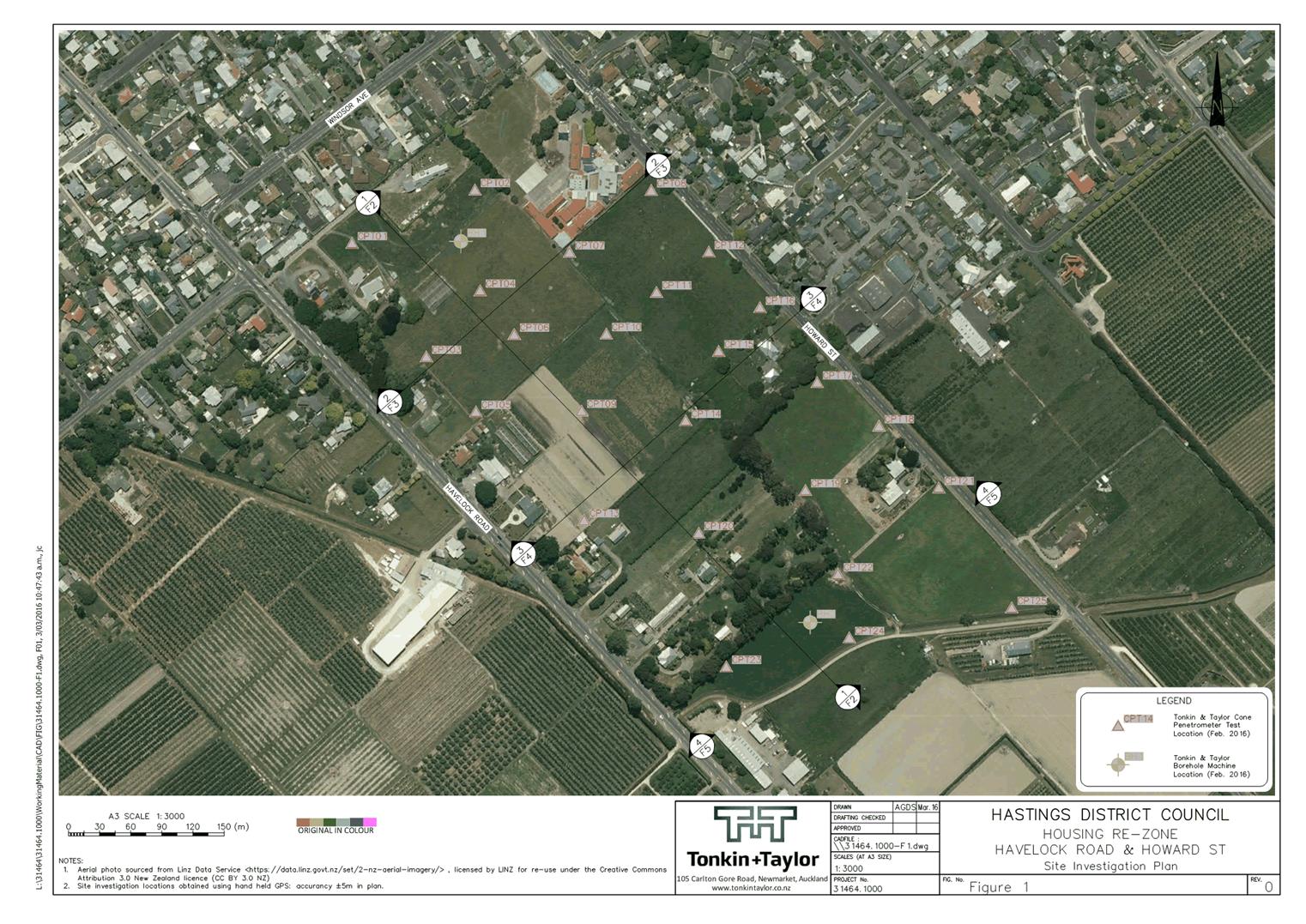
2. Notice of Requirement to designate land for road corridor with associated infrastructure for water, waste water, and stormwater; and stormwater corridor - NOR Howard Street
Document 2 Containing these attachments:
Attachment 2 Application and Notice of Requirement for Roading & Stormwater Servicing Corridor Pg 1
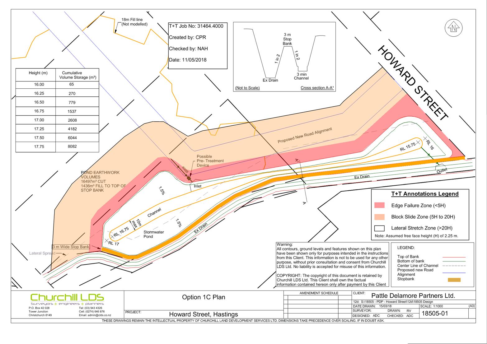
Attachment 3 Plans of the Notice of Requirement Pg 51
Attachment 4 Public Notice 22 Sept FINAL Pg 63
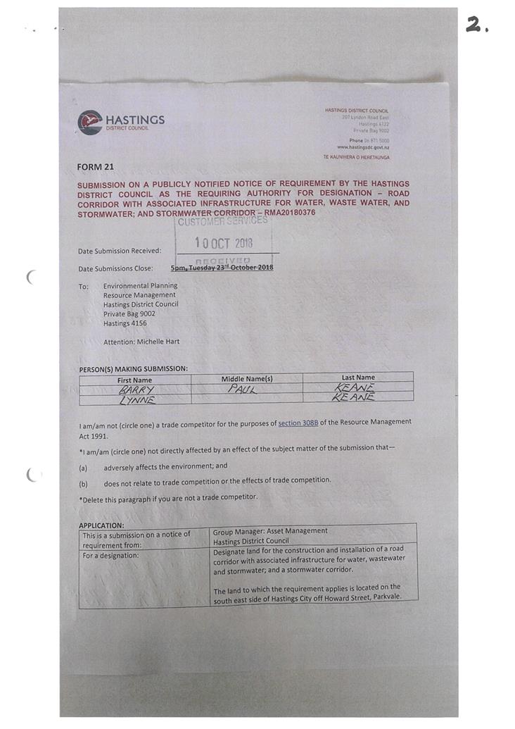
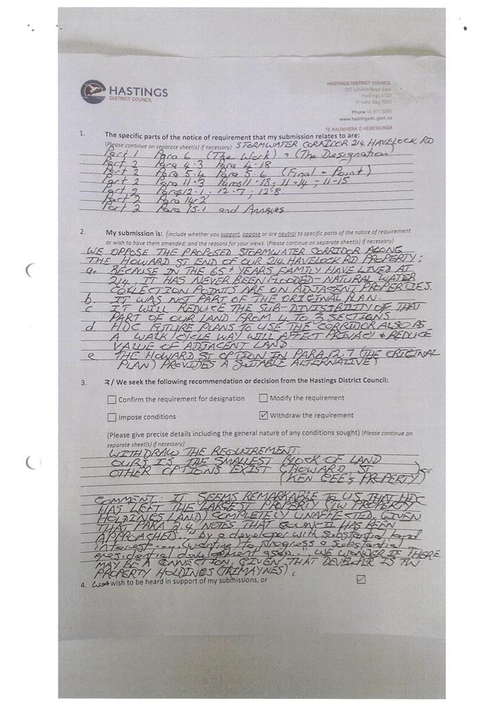
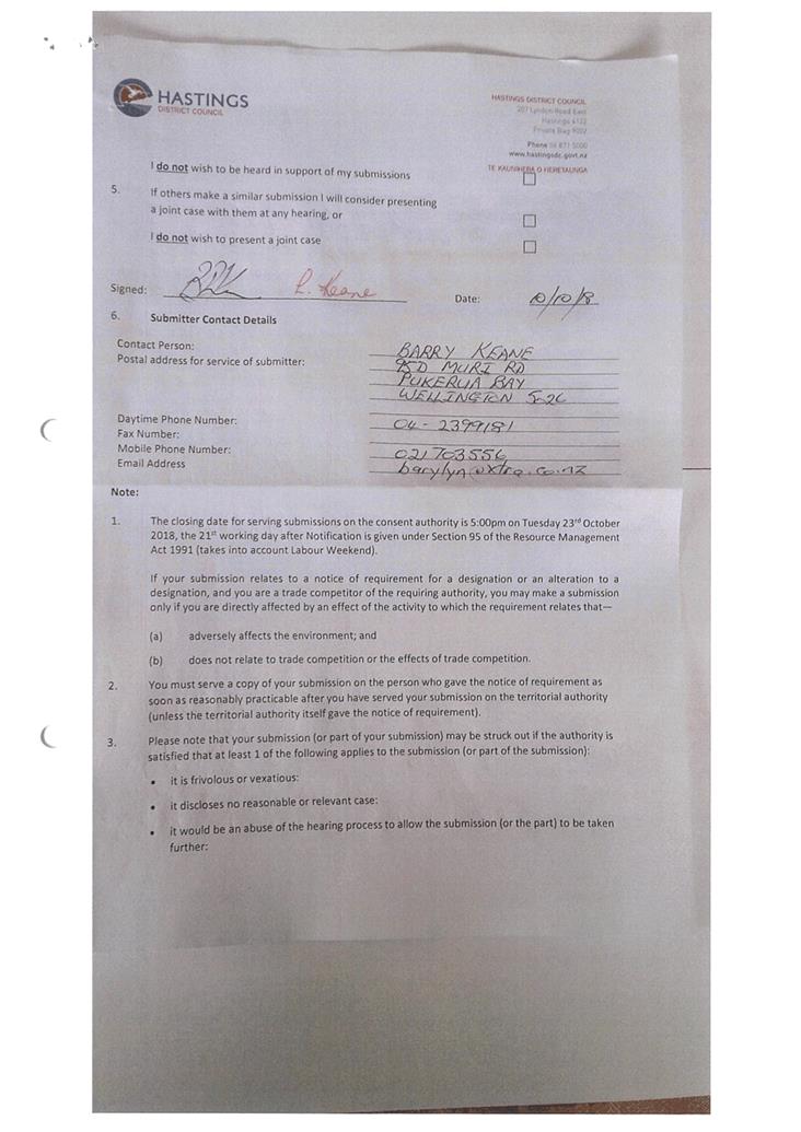
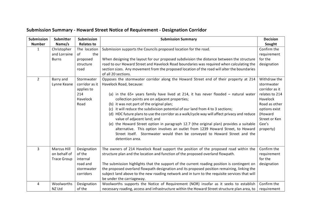
Attachment 5 Scanned Submissions (merged) Pg 65
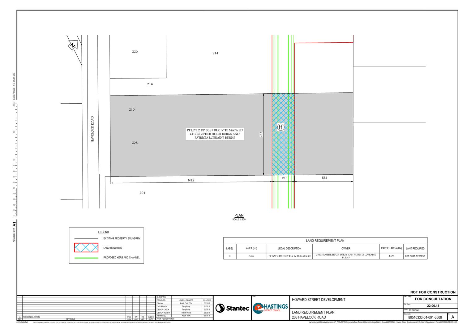
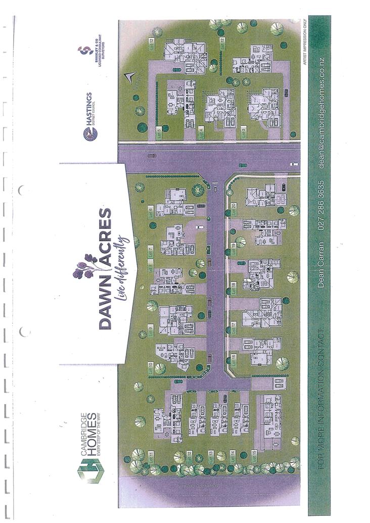
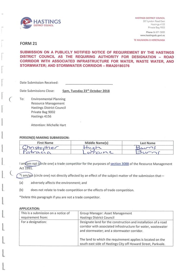
· C and P Burns Pg 65
· B and L Keane Pg 77
· TW Property Holdings Ltd Pg 80
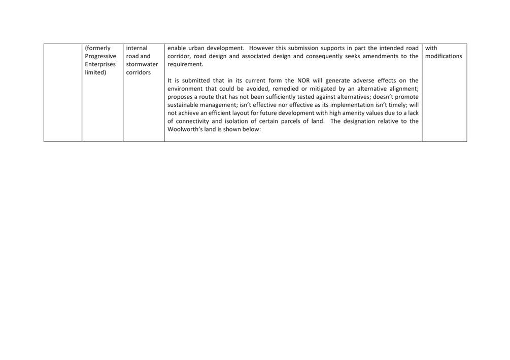
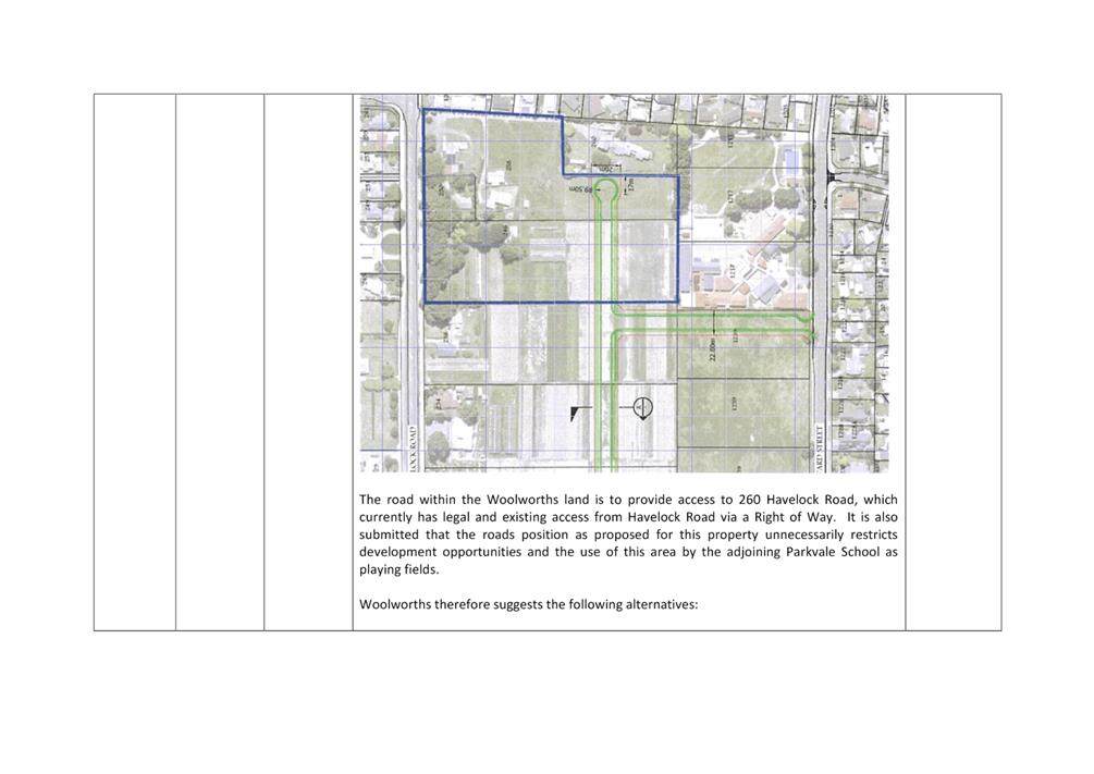
· Woolworths NZ Ltd Pg 83
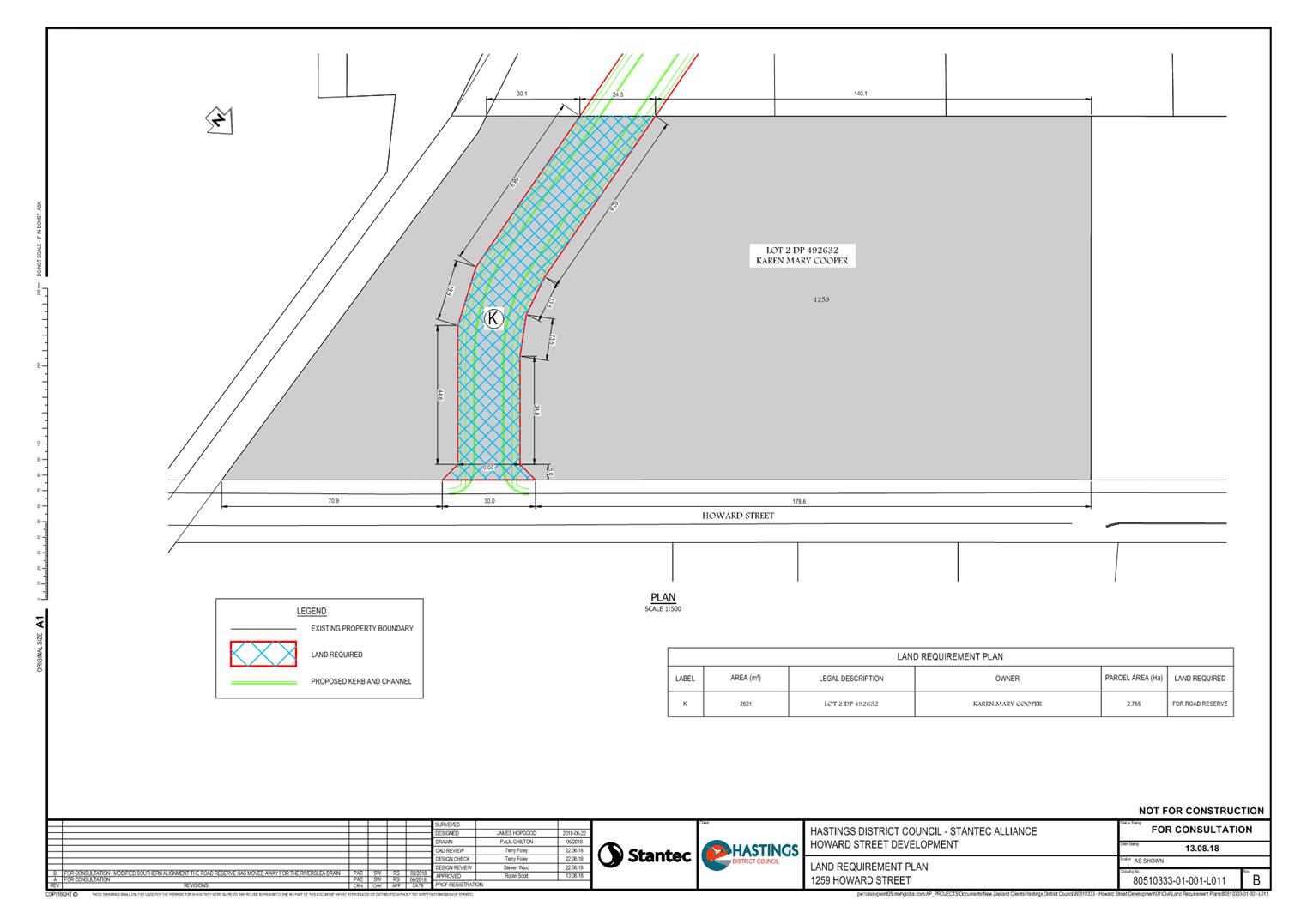
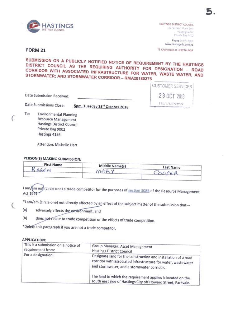
· KM Cooper Pg 92
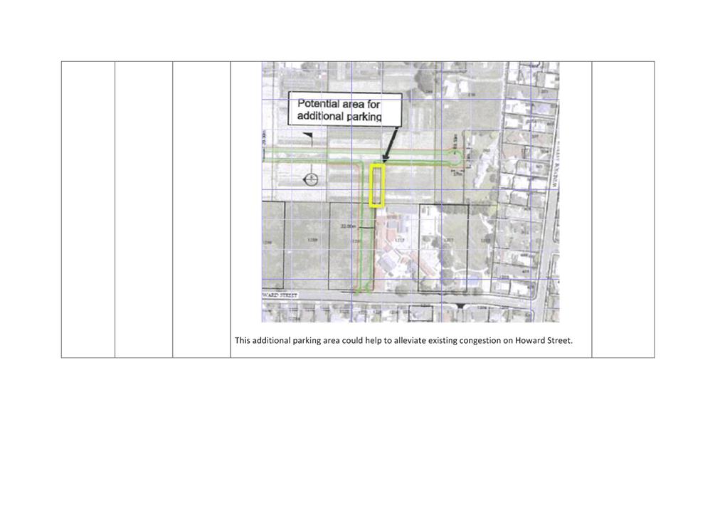
· Ministry of Education Pg 102
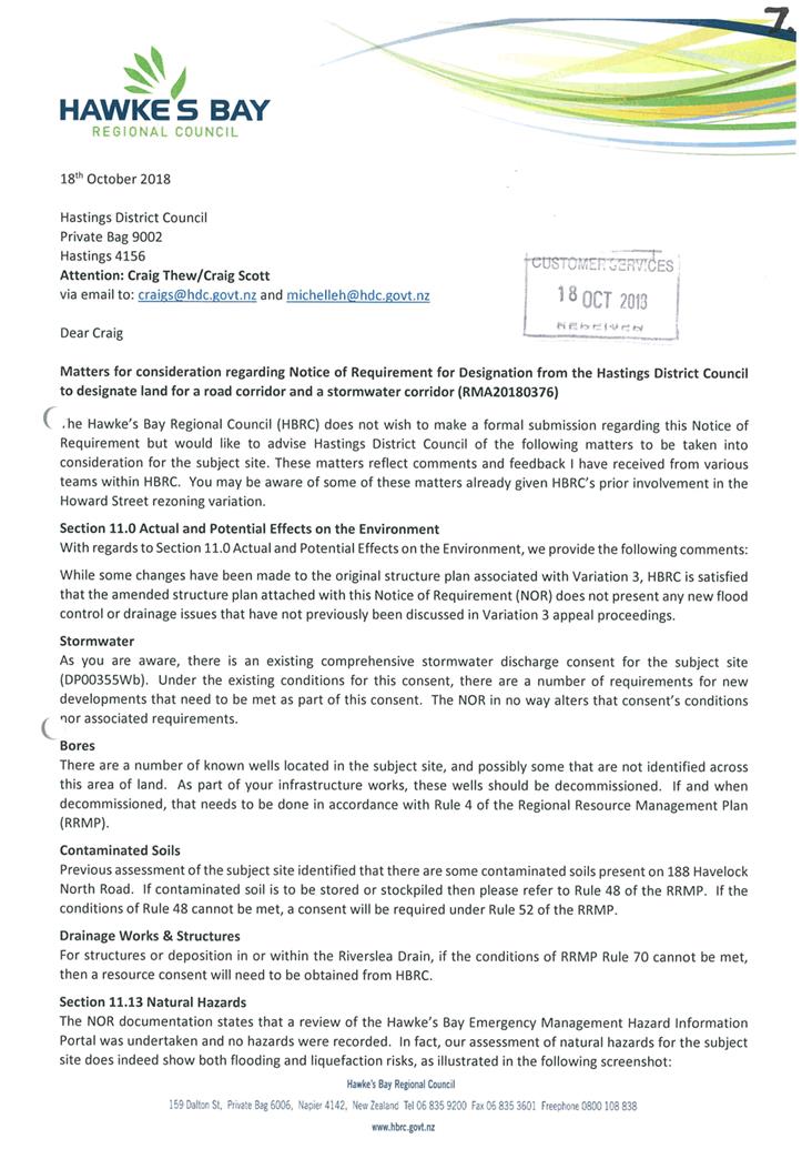
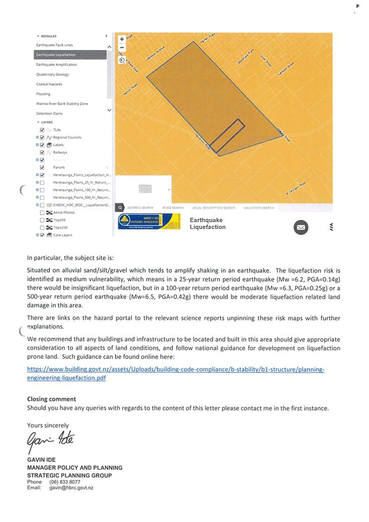
· HB Regional Council Pg 104
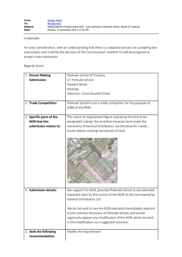
Attachment 6 Late submission (Parkvale School, Board of Trustees) Pg 107
Attachment 7 Submission Summary for Howard Street (2) Pg 109
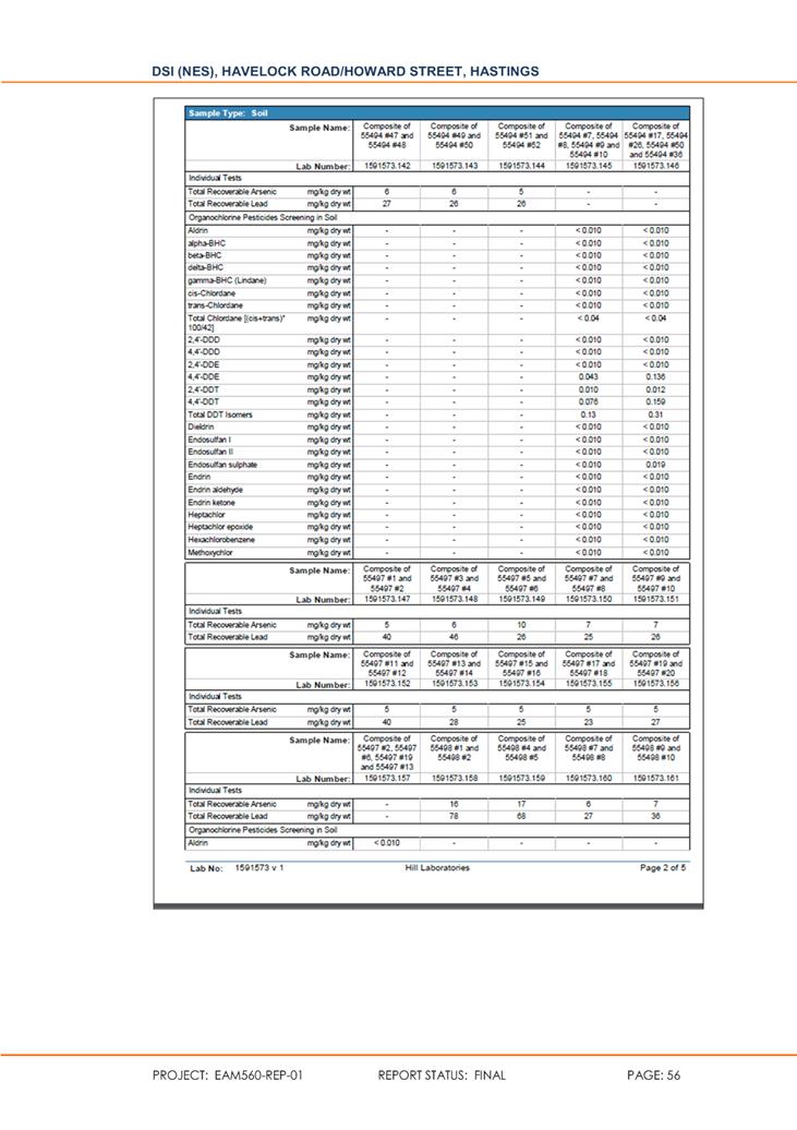
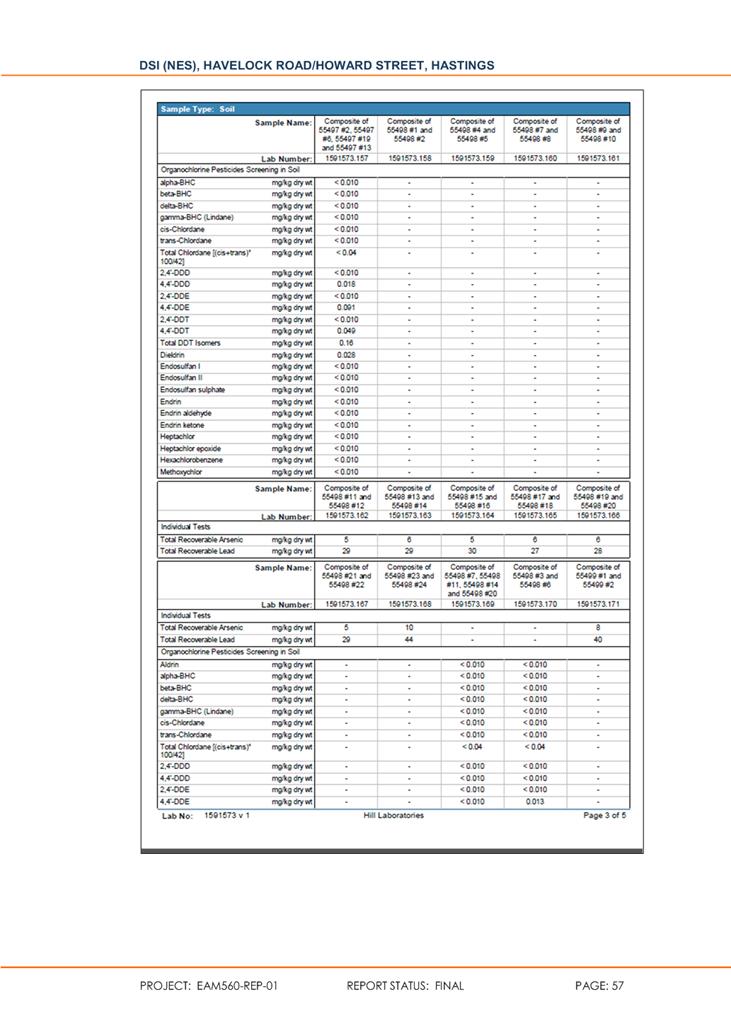
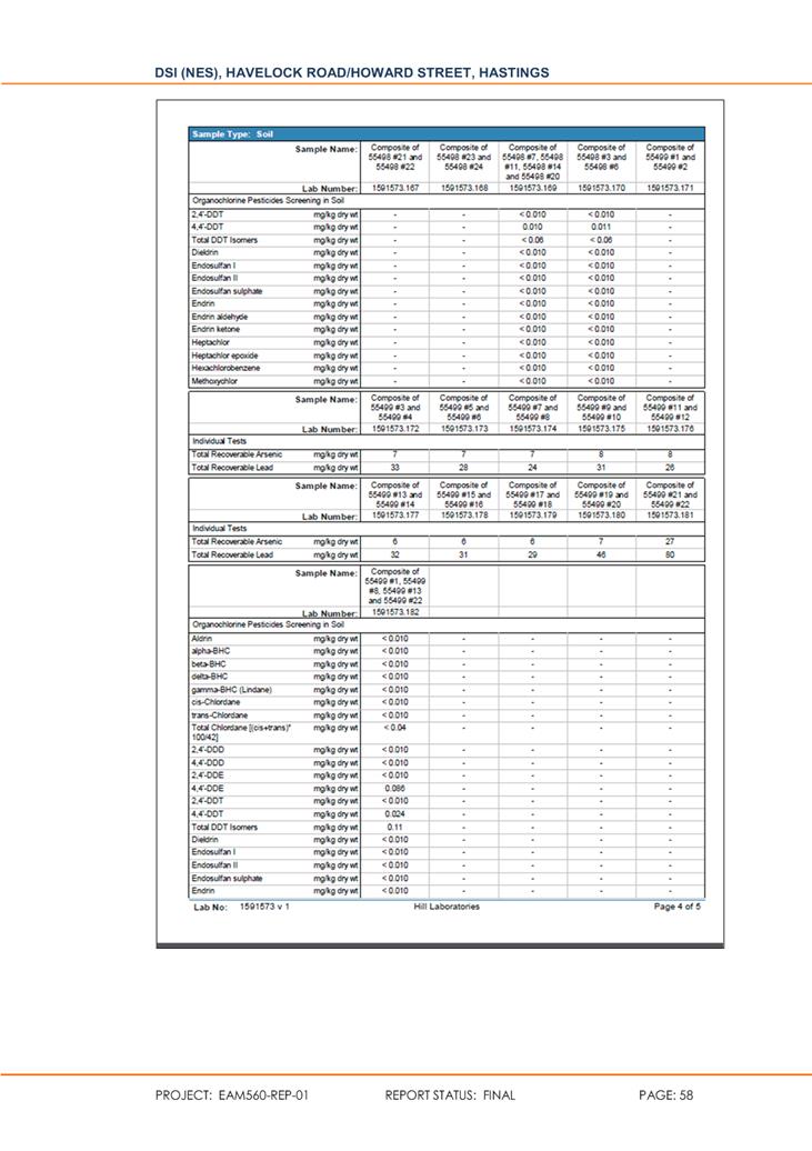
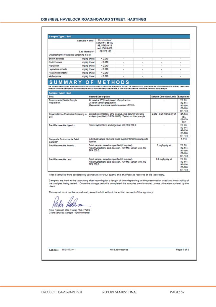
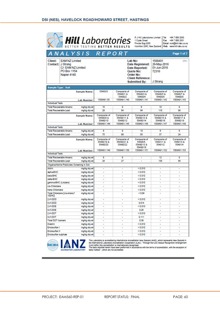
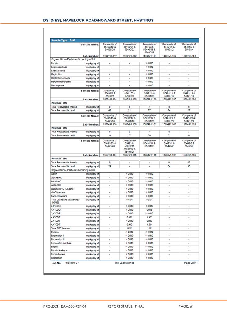
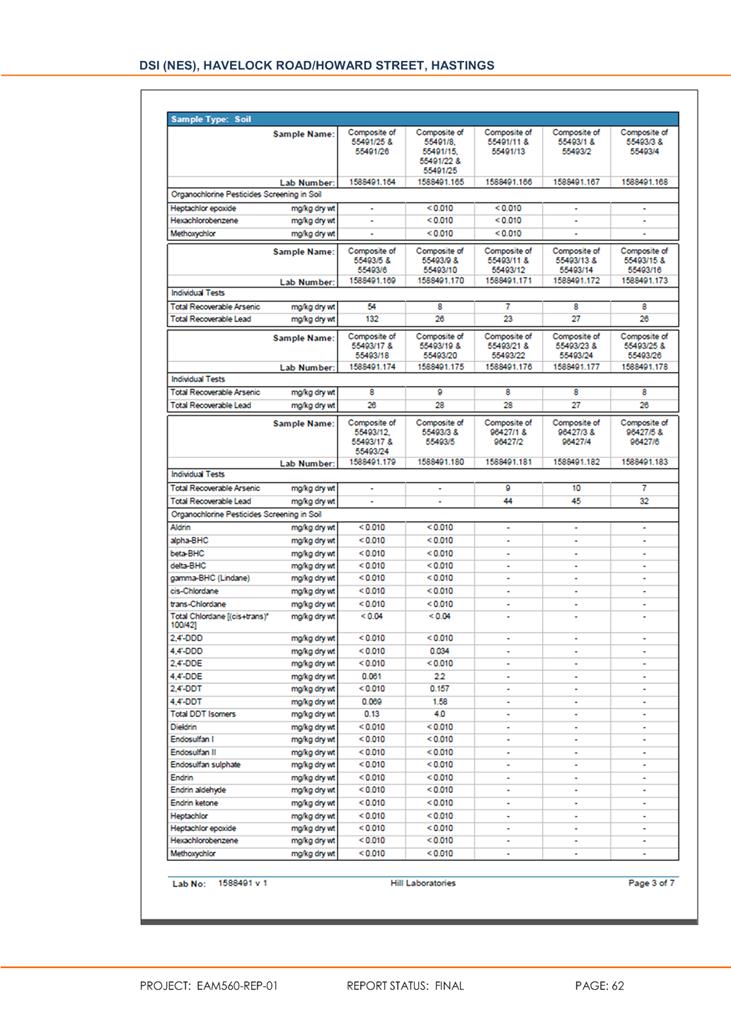
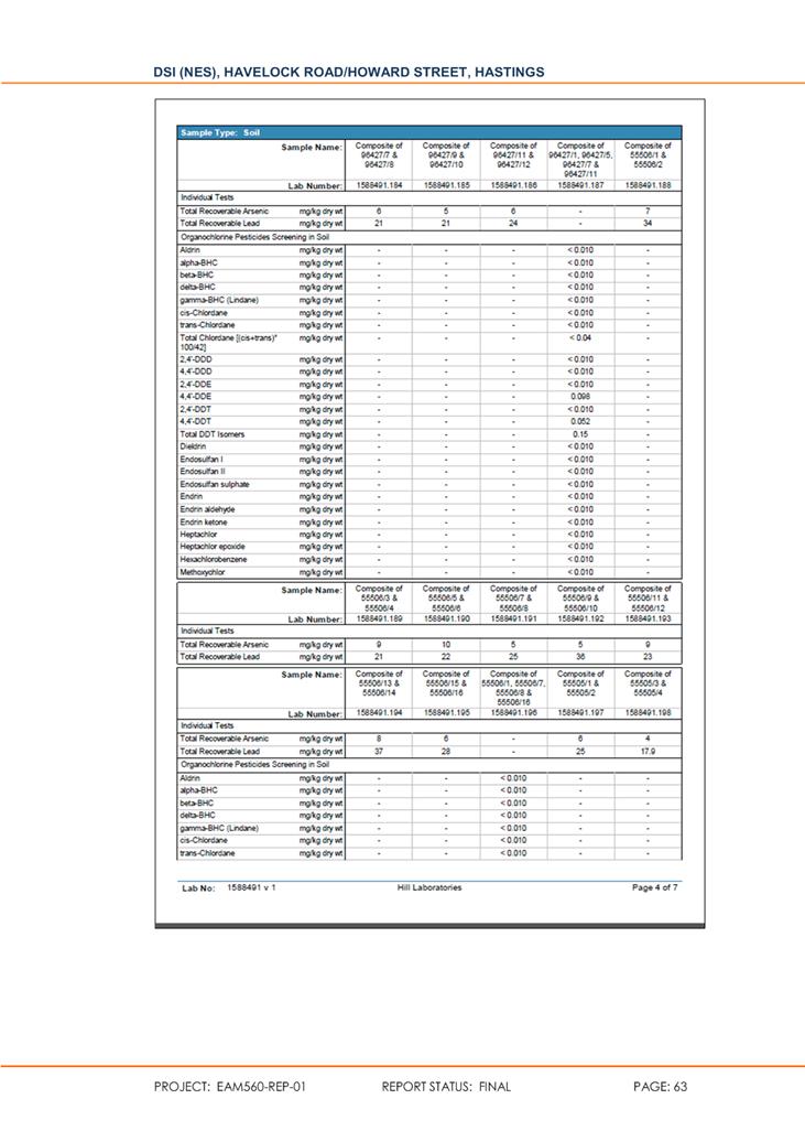
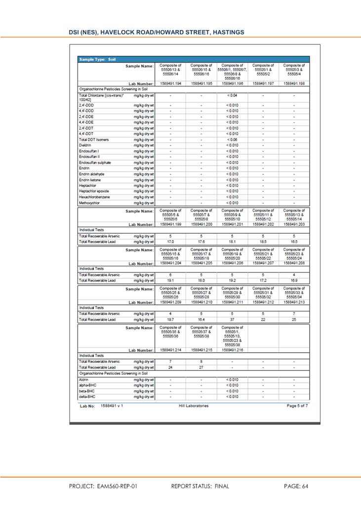
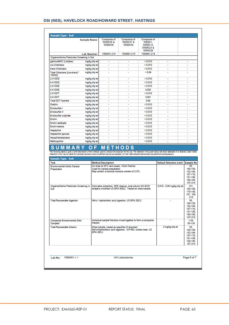
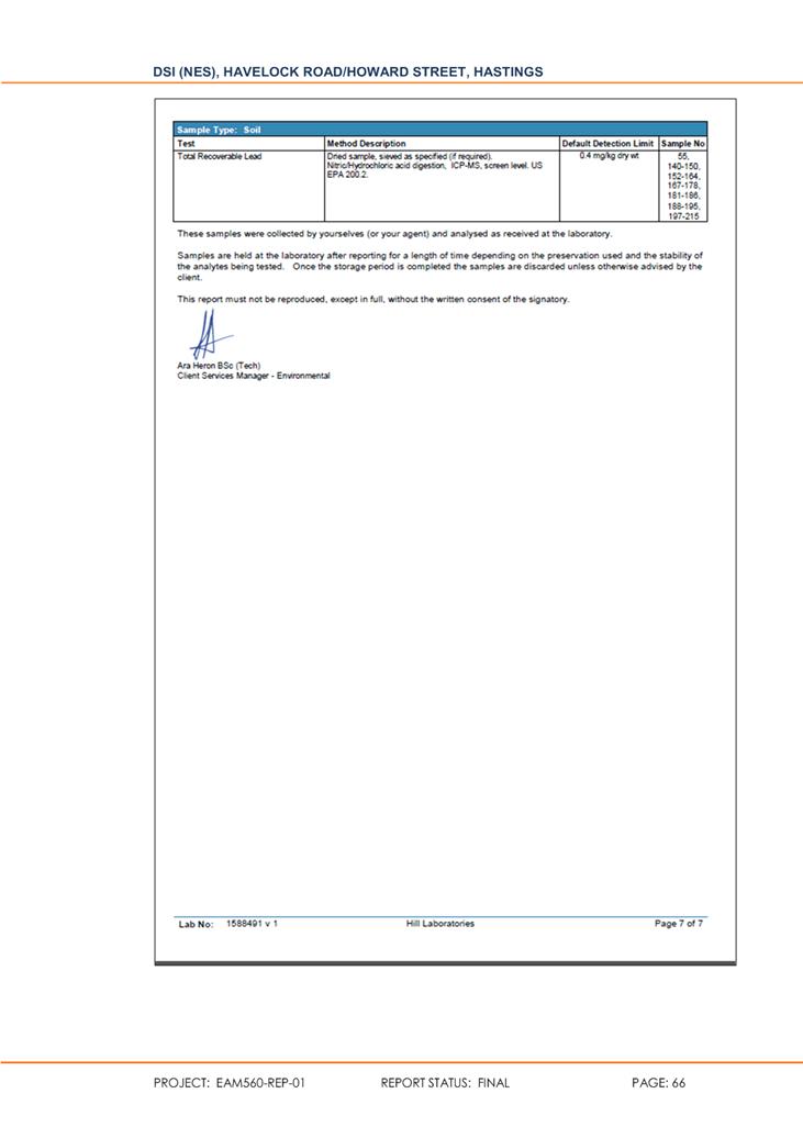
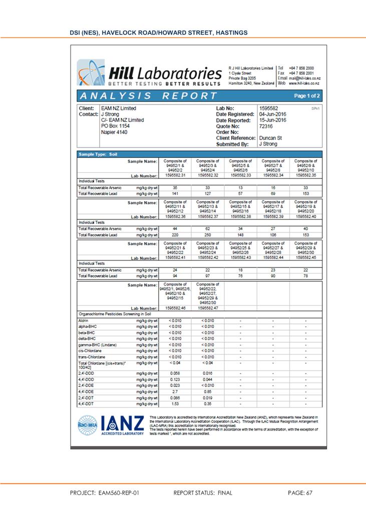
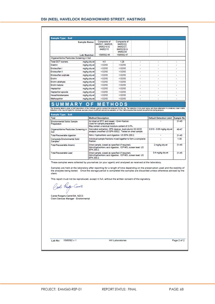
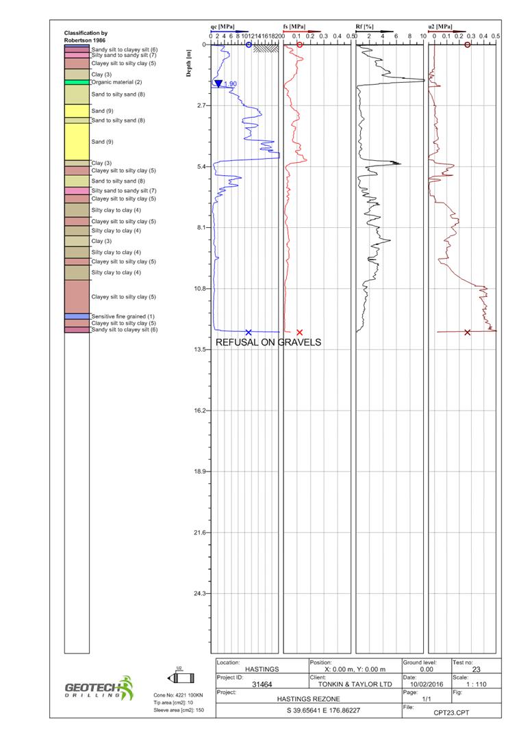
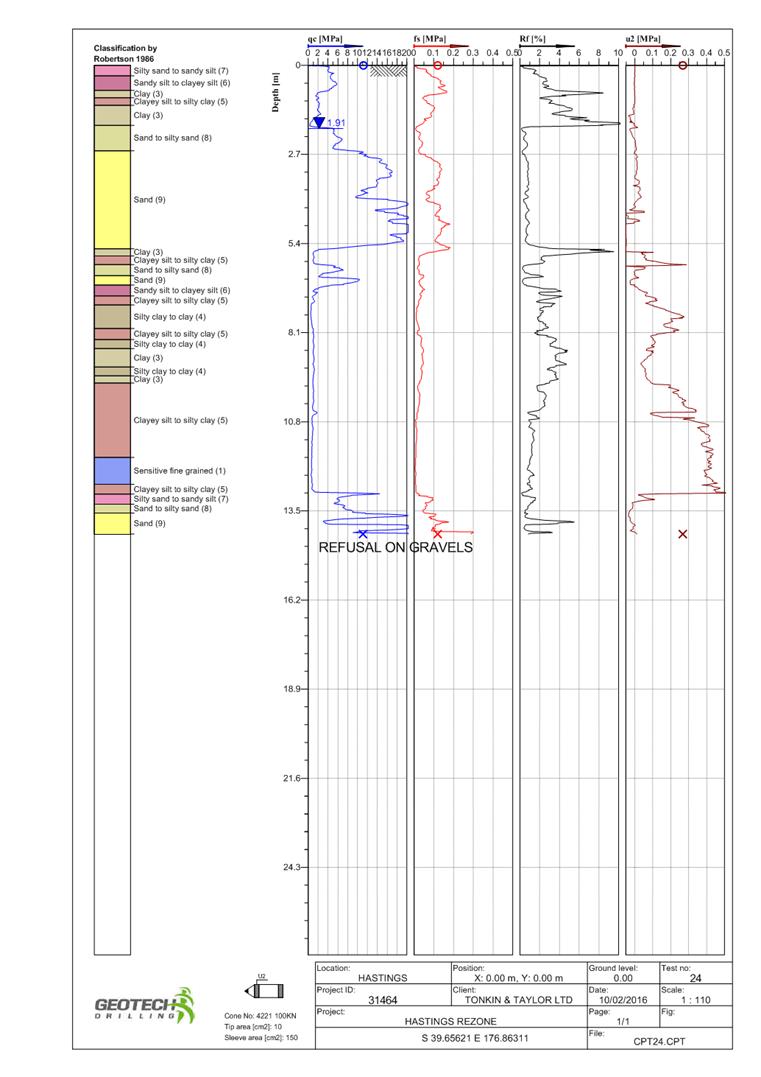
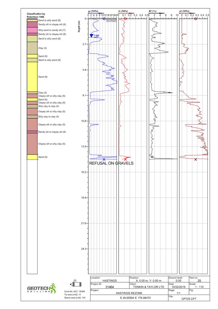
Attachment 8 Detailed Site Investigation Report NESCS - EAM Limited Pg 119
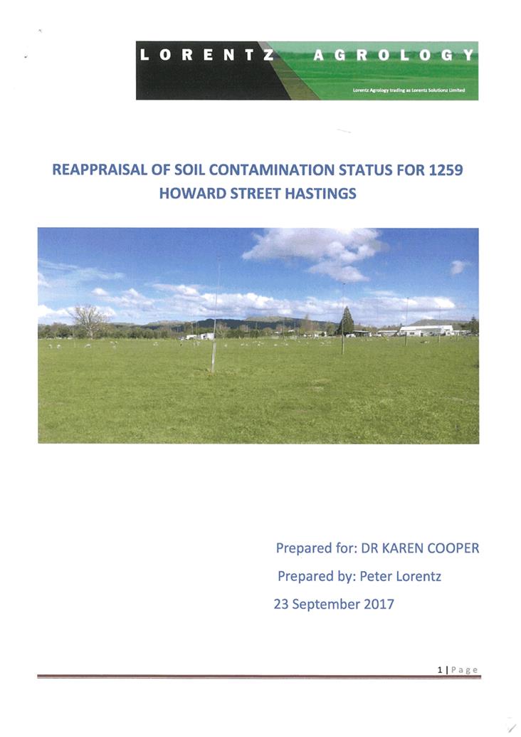
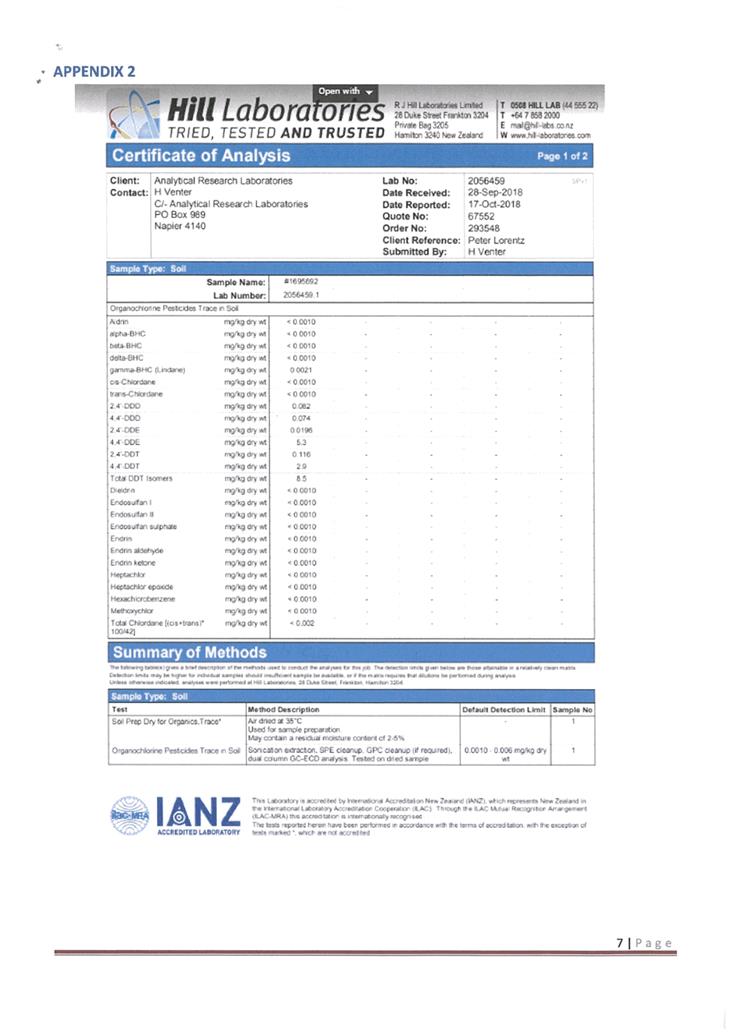
Attachment 9 Lorentz Agrology Soil Appraisal for Karen Cooper Pg 171
Attachment 10 Stormwater Capacity Assessment Pg 195
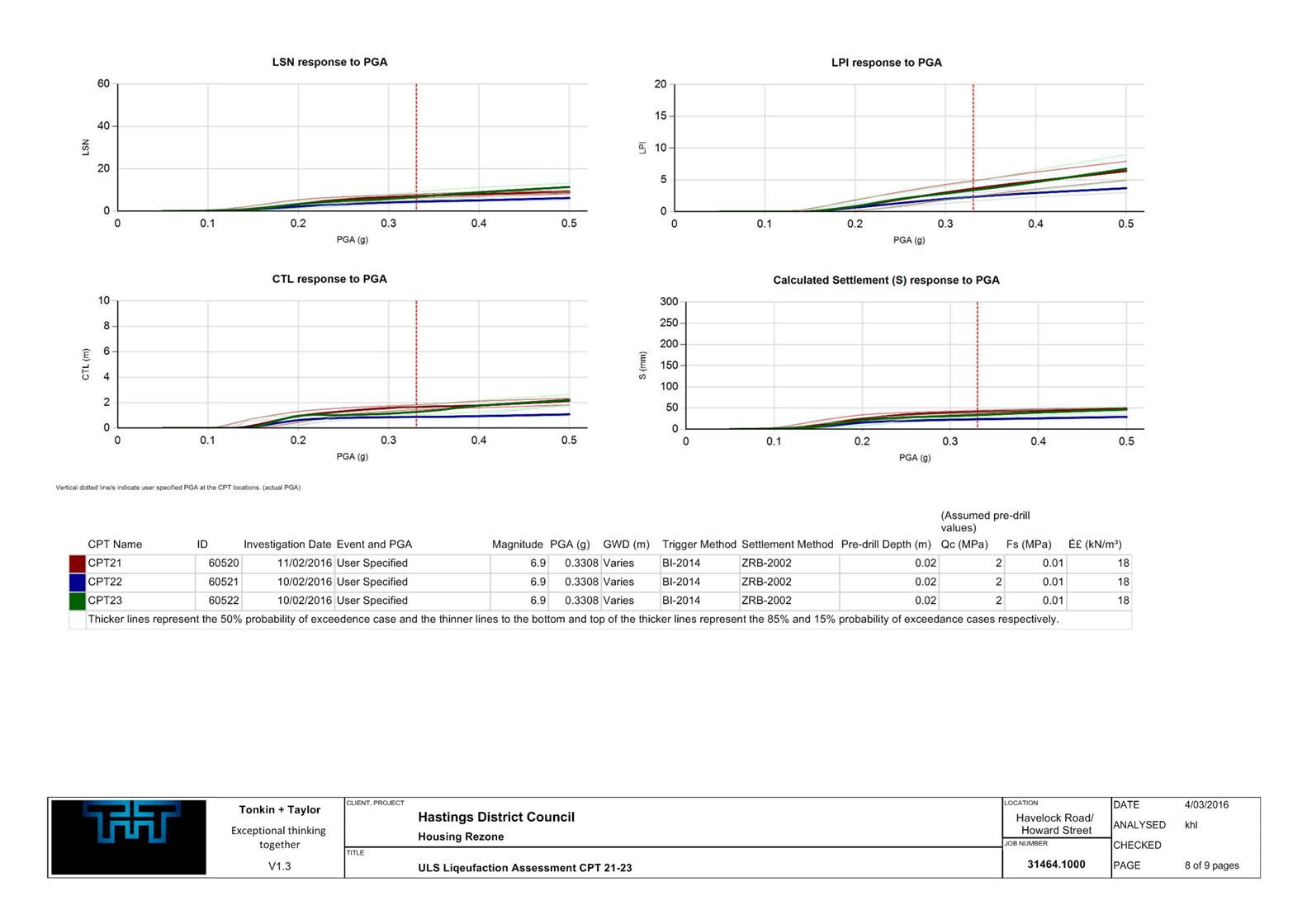
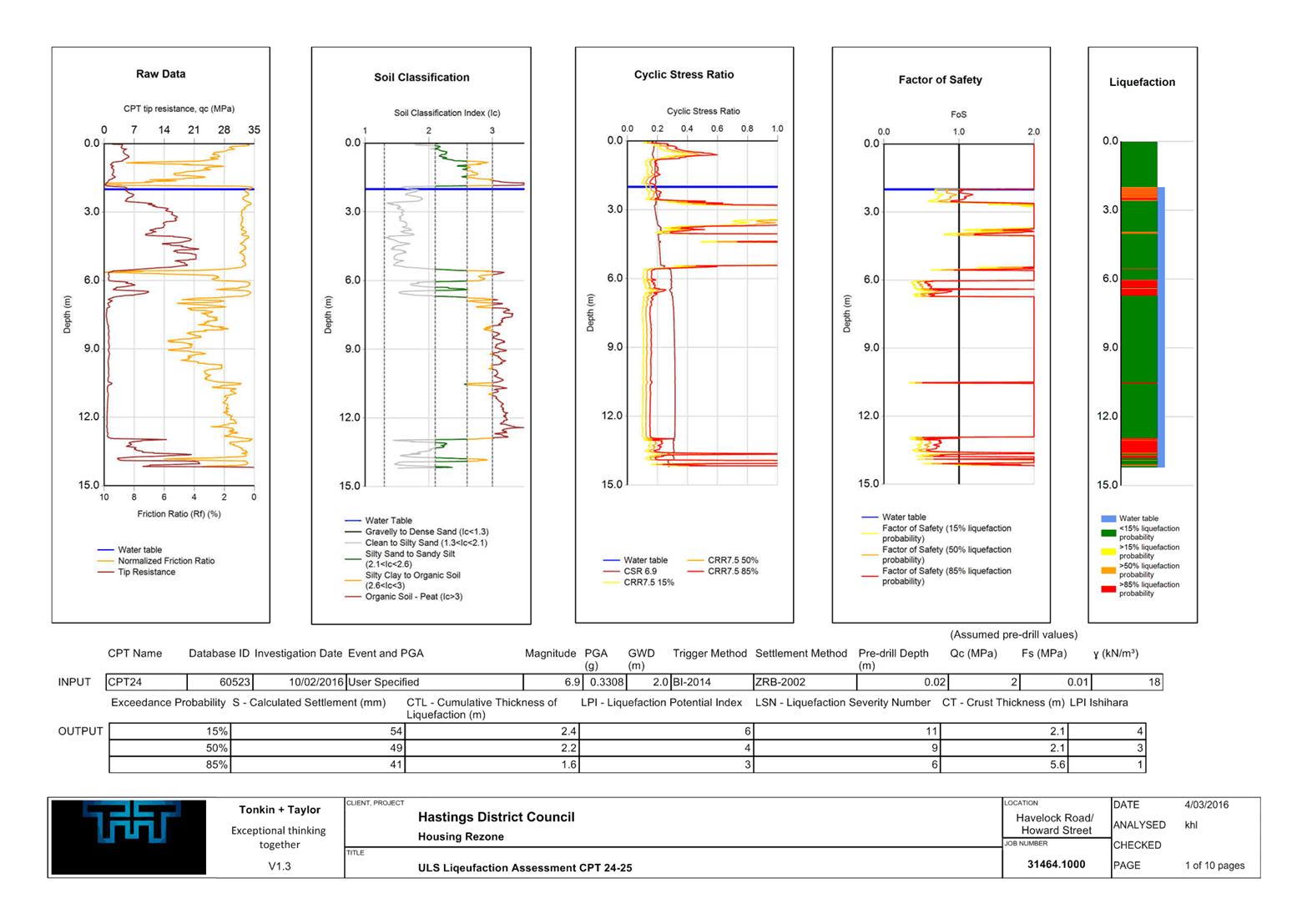
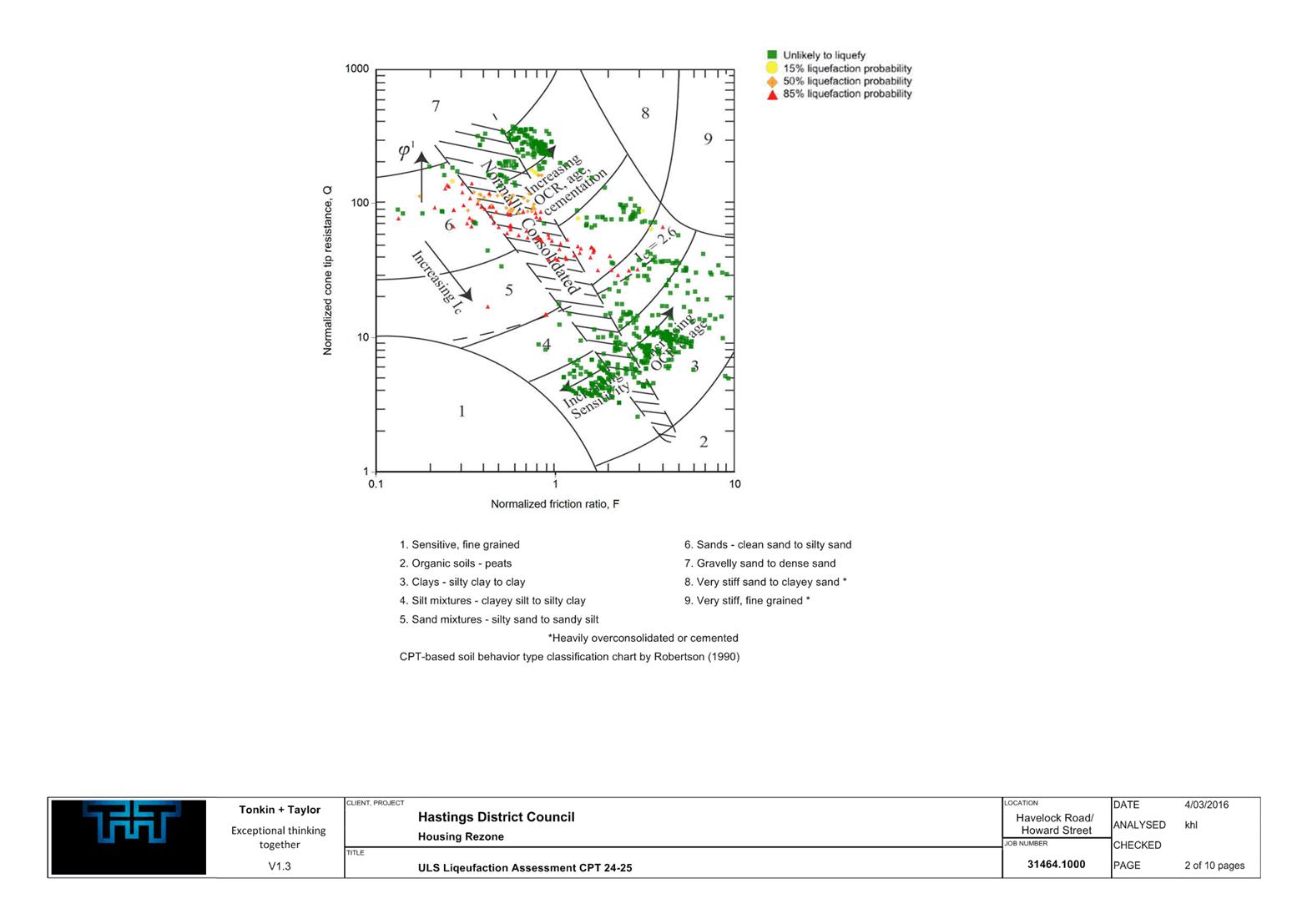
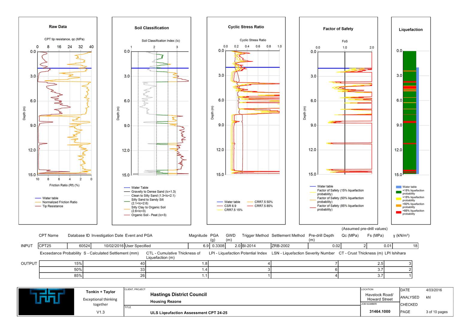
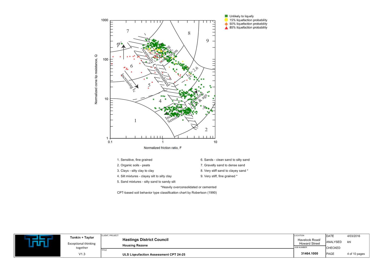
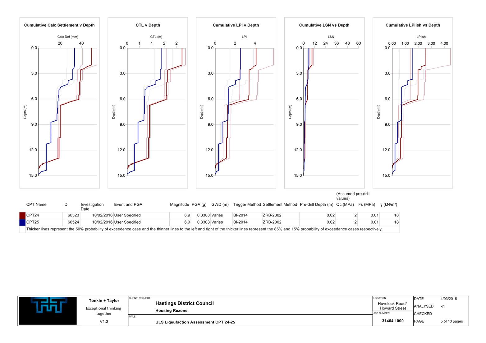
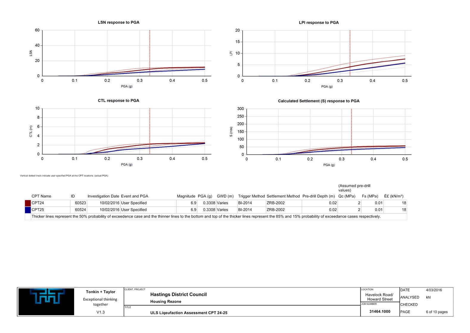
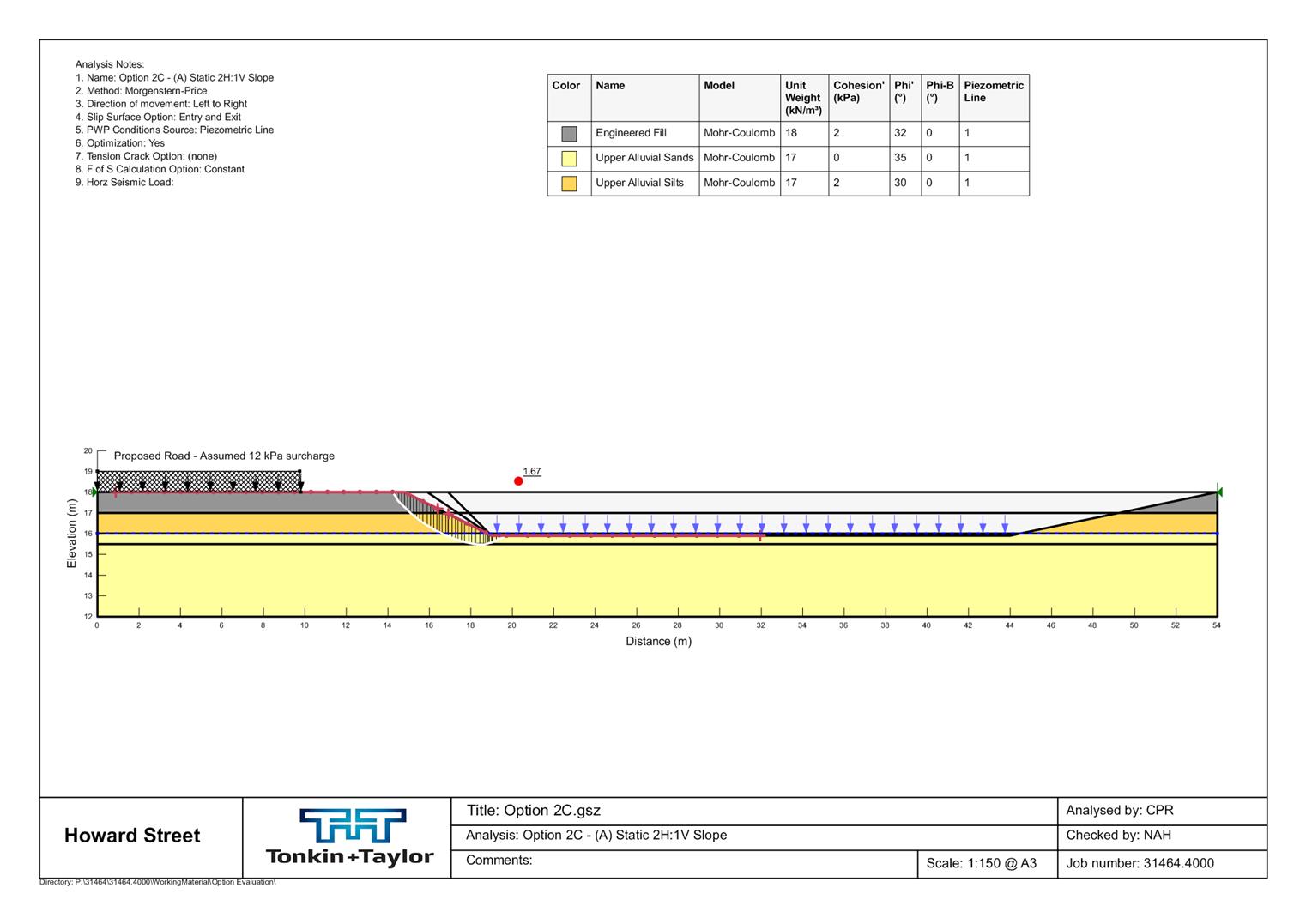
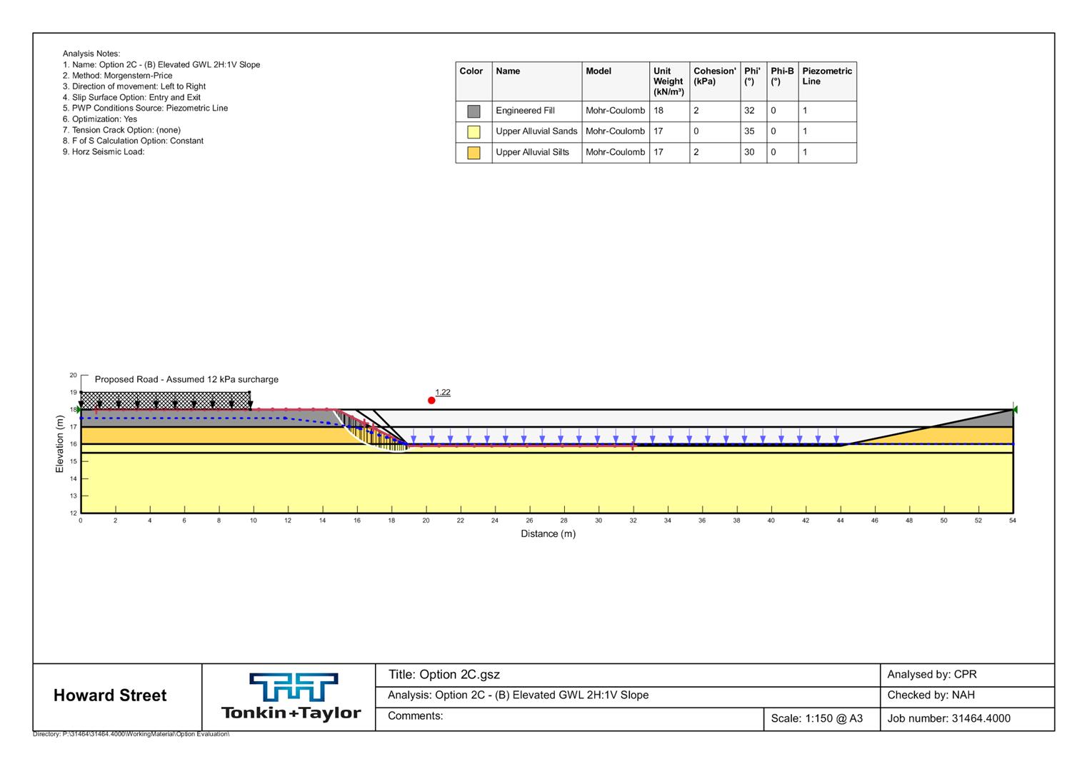
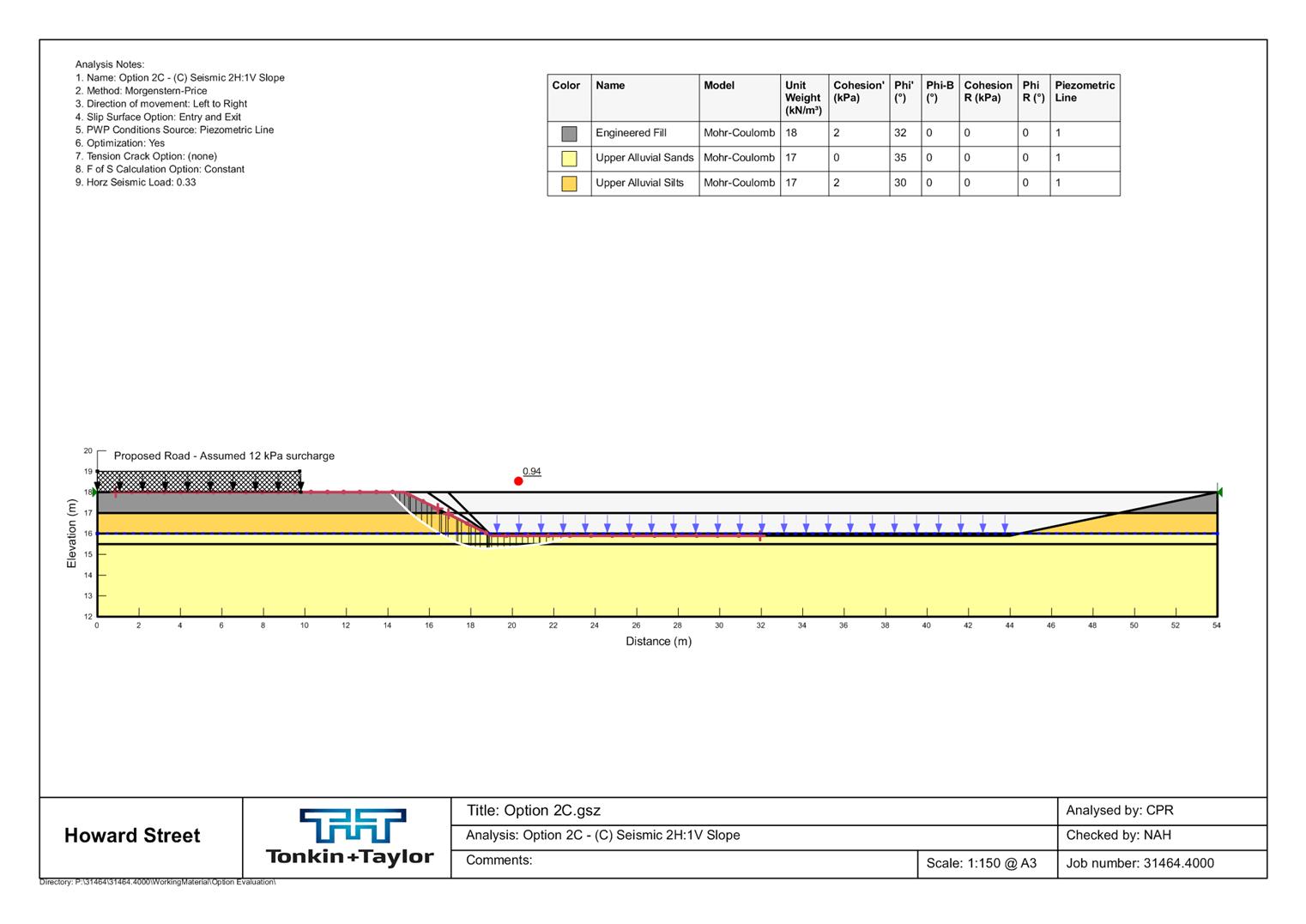
Attachment 11 Additional Stormwater analysis- Tonkin & Taylor Pg 215
Attachment 12 Submission Summary HDC Stormwater Manager Pg 266
Attachment 13 Wastewater Servicing Background Report Pg 267
Attachment 14 Overall TIA Transport Impact Assessment Pg 297
Attachment 15 Roading and Stormwater advice for Howard St NOR - Additional information Pg 321
Submission Summary - HDC Stormwater Manager |
Attachment 12 |
Submission Number |
Submitter Name/s |
Submission Relates to |
Submission Summary |
Decision Sought |
Stantec Stormwater Comments |
1 |
Christopher and Lorraine Burns |
The location of the proposed structure road |
NOT STORMWATER RELATED |
Confirm the requirement for the designation |
N/A |
2 |
Barry and Lynne Keane |
Stormwater corridor as it applies to 214 Havelock Road |
Opposes the stormwater corridor along the Howard Street end of their property at 214 Havelock Road |
Withdraw the stormwater corridor as it relates to 214 Havelock Road as other options exist (Howard Street or Ken Gee's property) |
The overall fall of the Howard Street development land is to the south near Havelock Road. The proposed stormwater corridor was to allow stormwater flow from the rear of the TW Property Holdings and Fyfe (with a connection through TW Holding's land) sites to drain without significant earthworks and retaining walls (in the order of 1m near the Fyfe TW Holding boundary) to raise the land and drain back to Howard Street. This has resulted in a linkage stormwater flow path being required through either the Keane or Burns properties. The ideal location is unknown due to no proposed scheme plan in place or design levels confimred. But, the flow path could be made to work from the location proposed moving south through to a location on Burn's property at the boundary between Cooper and Fyfe. Another option would be for stormwater to be conveyed along the back of TW Holding's, through Fyfe and Coopers to the new internal road. While these other options may be achievable, HDC has chosen the path over the Keane property as it represents the corridor which provides the most natural and least restrictive flow path from the Council's perspective. The location was chosen as it is located towards the lowest point of the TW Holdings site, and takes the shortest possible route to the proposed internal road corridor, ensuring that as small as possible additional land will used up for the corridor. It has also been proposed for the Keane land rather than the Gee property, as the Gee land is further upslope, meaning less efficient and effective servicing of the TW Holdings site, and may require additional engineeering works (of the TW Holdings site) to achieve a suitable stormwater outlet to the stormwater corridor. The other options also have increased difficulties, the Burns property option would bequire a bend in the overland flow path which is difficult to achieve, as well as requiring additional land, and muliple land owners. The Cooper/Fyfe option would require additional land and multiple landowners also, neither option utilises the flowpath that will be created by the peroposed internal road corridor. |
3 |
Marcus Hill on behalf of Trace Group |
Designation of the internal road and stormwater corridors |
The owners of 1239 Howard Street support the position of the proposed road within the within the structure plan, and also the location and function of the proposed overland flow path within 214 Havelock Road. |
Confirm the structure plan and the location and function of the proposed overland flow path |
Noted |
4 |
Woolworths NZ Ltd |
Designation of the internal road and stormwater corridors |
This submission supports the intention by Council in this NOR to ensure appropriate land is available to provide critical services to the structure plan area, particularly for the conveyance of stormwater and agrees the timely provision of servicing by Council is better than a developer led, piecemeal approach to the construction of services. The submission acknowledges intent around stormwater management for 5 and 50 year events. However, the submission questions whether the high level stormwater assessment (Stormwater Capacity report prepared by MWH), which appears to consider existing stormwater capacity only is sufficient, as the report concludes the structure plan area is undersized in some catchments and that further analysis, including topographical surveys is necessary to ascertain a more detailed stormwater network design. Woolworths submits that Council needs to undertake this further assessment so that the design will appropriately provide for future development within the structure plan area, thereby more appropriately dealing with stormwater conveyance and discharge. |
Confirm the requirement with modifications |
The critical downstream flood levels have not been confirmed by HBRC. The 20% and 2% AEP events will be used to set the road levels. However, if the proposed internal road is generally laid at existing ground levels the Woolworths site does have an issue with conveyance back to the proposed internal road network. The property would either need to be significantly raised (in the order of 0.7m at the Norton Road corner) to drain back to the internal road or alternatively overland flows split and allow the property to drain back to the intersection of Norton Road and Havelock Road. Allowing flows back to the intersection of Norton Road and Havelock Road will require some mitigation of peak flows from the development site. The relocation of the road to a site adjacent to Parkvale School will not make the site unserviceable for stormwater, but it may reduce the area of the site that can be serviced by gravity to the internal road. HDC's preferred solution is to direct the majority of runoff from the development area to the Stormwater Detention Area which is designed to ensure stormwater neutrality and quality treatment , and will not put additional strain on the existing network. Any stormwater being diverted to the Havelock Road stormwater network may require mitigation, or alternatively a pumped option discharging to the internal road. |
5 |
Karen Cooper |
Designation of the internal road and stormwater corridors |
It is submitted that consideration should be given to an alternative roading alignment, which allows for one road to be less than 20 metres in width (secondary road and currently specified in "Plan K") which could still include water, wastewater and stormwater services. This secondary road could be used if necessary for vehicle access but would be primarily a pedestrian, cycling track. There is thus the potential for that part of the road (as is currently specified in "Plan K") to be reduced to 10 metres in width (6 metres for the road plus some road reserve for services). Access for any residential development on 1259 Howard St would be from Howard Street rather than the structure road. The rezoned area would therefore have a primary road by the Parkvale School ("Plan A" in the Notice of Requirement) and a secondary road through 1259 Howard St (to replace "Plan K"). This would allow additional land to be made available for residential use. |
Confirm the requirement with modifications |
A reduced road width for conveyance of the 2%AEP (1:50 year) flood event could be possible, the vertical grade from Howard Street down to the proposed detention basin would need to be modelled to confirm the increased depth of flow as this may be more than the 100mm at centreline as required in the HDC Code of Practice (if designated a Local Road, or 200mm if Lane). The designation level for the road through this section would also need to be confirmed. |
6 |
Ministry of Education |
Designation of the internal road corridor |
NOT STORMWATER RELATED |
Confirm the requirement with modifications |
N/A |